NAVIGATION: and CARTOGRAPHY 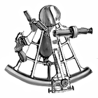
Note: This section is presently on a long two part scroll. Cartography occupies the bottom half. Please visit often as this section is growing rapidly. We will try to improve the cyber navigability of this section beyond simple scrolling as we continue to add content. Thank you for your patience.
Welcome to NAVIGATION , this section will deal not only
with the arts and sciences of navigation but its history and impact on the world
as well. This is also the section in which we are growing a data base on CARTOGRAPHY , the arts and sciences of pictorial presentation of spatial information. NAVIGATION is not the only place within the American
Admiralty Books blog that you may find works on navigation. The English language
classics on navigation were first described in our NAUTICAL
CLASSICS section. In that section we described the importance of such works as:"BOWDITCH", "DUTTON", AND "CHAPMAN" EDITORIAL NOTE: WE HAVE LOST SOME LINKS ON THIS PAGE, THANK YOU FOR YOUR PATIENCE AS WE TRY TO REPAIR. MEANWHILE IF A DESCRIBED BOOK'S LINK IS MISSING PLEASE TRY THE
NAVIGATION AND CARTOGRAPHY BOOKSHELF

AMERICAN ADMIRALTY BOOKS PRIVACY POLICIES NOTICE
AMERICAN ADMIRALTY BOOKS PRIVACY POLICIES NOTICE
"COOKIES NOTICE" : HOW GOOGLE USES DATA:
American Admiralty Books does not use "cookies", Google as system provider, and many sites linked yo on this site do use cookies. There is no "block cookies" option for Google, to visit this site is to agree to the Google privacy policy linked to above. By not clicking on links within the site you avoid third party cookies. Visitors may read posts and special interest sections without incurring any cookies known to us other than those described in the Google Privacy statement linked above. Many posts and all special interest sections contain links to related Amazon books, videos and other related products. If you enter Amazon through our links you agree to the Amazon privacy policy linked above. Any links cited as "Read More" may take you to publishers on subjects addressed in this blog who may or may not use cookies. EUROPEAN VISITORS ARE WARNED THAT MOST ADVERTISERS AND "READ MORE" SOURCES LINKED TO, ARE AMERICAN AND NOT SUBJECT TO THE EU REQUIRED NOTICES INVOLVING "COOKIES". WE CAN NOT ASSURE VISITORS TO THIS SITE THAT ANY VISIT WILL NOT RESULT IN THE DELIVERY OF "COOKIES". IF "COOKIE ADVERSE" ENTER AT YOUR OWN RISK. THIS NOTICE SUPPLEMENTS THE REQUIRED EU NOTICE PROVIDED BY GOOGLE TO EU VISITORS. IF YOU DID NOT SEE THE REQUIRED EU NOTICE BEFORE ENTERING OUR SITE PLEASE REPORT THE INCIDENT IN THE COMMENTS SECTION AT THE END OF ANY SCROLLED PAGE. THANK YOU.
Louisisana Residents are reminded that you are personally liable under Louisiana law for local and state sales taxes for on line purchases. Louisiana tax authorities expect you to track such purchases, compute the sales tax due and remit same with your annual state income tax report.
Welcome to NAVIGATION , this section will deal not only
with the arts and sciences of navigation but its history and impact on the world
as well. This is also the section in which we are growing a data base on CARTOGRAPHY , the arts and sciences of pictorial presentation of spatial information. NAVIGATION is not the only place within the American
Admiralty Books blog that you may find works on navigation. The English language
classics on navigation were first described in our NAUTICAL
CLASSICS section. In that section we described the importance of such works as:"BOWDITCH", "DUTTON", AND "CHAPMAN" EDITORIAL NOTE: WE HAVE LOST SOME LINKS ON THIS PAGE, THANK YOU FOR YOUR PATIENCE AS WE TRY TO REPAIR. MEANWHILE IF A DESCRIBED BOOK'S LINK IS MISSING PLEASE TRY THE
American Admiralty Books does not use "cookies", Google as system provider, and many sites linked yo on this site do use cookies. There is no "block cookies" option for Google, to visit this site is to agree to the Google privacy policy linked to above. By not clicking on links within the site you avoid third party cookies. Visitors may read posts and special interest sections without incurring any cookies known to us other than those described in the Google Privacy statement linked above. Many posts and all special interest sections contain links to related Amazon books, videos and other related products. If you enter Amazon through our links you agree to the Amazon privacy policy linked above. Any links cited as "Read More" may take you to publishers on subjects addressed in this blog who may or may not use cookies. EUROPEAN VISITORS ARE WARNED THAT MOST ADVERTISERS AND "READ MORE" SOURCES LINKED TO, ARE AMERICAN AND NOT SUBJECT TO THE EU REQUIRED NOTICES INVOLVING "COOKIES". WE CAN NOT ASSURE VISITORS TO THIS SITE THAT ANY VISIT WILL NOT RESULT IN THE DELIVERY OF "COOKIES". IF "COOKIE ADVERSE" ENTER AT YOUR OWN RISK. THIS NOTICE SUPPLEMENTS THE REQUIRED EU NOTICE PROVIDED BY GOOGLE TO EU VISITORS. IF YOU DID NOT SEE THE REQUIRED EU NOTICE BEFORE ENTERING OUR SITE PLEASE REPORT THE INCIDENT IN THE COMMENTS SECTION AT THE END OF ANY SCROLLED PAGE. THANK YOU.
NAVIGATION AND CARTOGRAPHY BOOKSHELF
Advertisement Professional Services:

William H. Toohey III AFNI
Toohey Marine LLC
Master Unlimited
ISO 9001:2015 Lead Auditor Class
(Bureau Veritas)
(Bureau Veritas)
ISM Lead Auditor (ABS Certified)
IMCA CMID Vessel Inspector
Vessel Compliance/Training/Safety Officer
Cell: 504-432-1958
Email: skiffrunner@gmail.com
 If you are just starting to study navigation you will enjoy NOVA's HISTORY OF NAVIGATION video, click on the link below where its posted for free viewing on YouTube: http://www.youtube.com/watch?v=8muOrcKev08
 Keep In Mind However, That While Western Man Was Developing Mathematical Methods Of Navigation The Ancient Polynesians Had Already Been Practicing A Highly Accurate Navigational Art That Required No Formal Mathematical Calculations Or Instruments: http://www.youtube.com/watch?v=uxgUjyqN7FU
 -------------------------------------------------------------------------------------------------- THE UNDERLYING INACCURACY IN TODAY'S NAVIGATION USE THE NOAA ZOC DATA
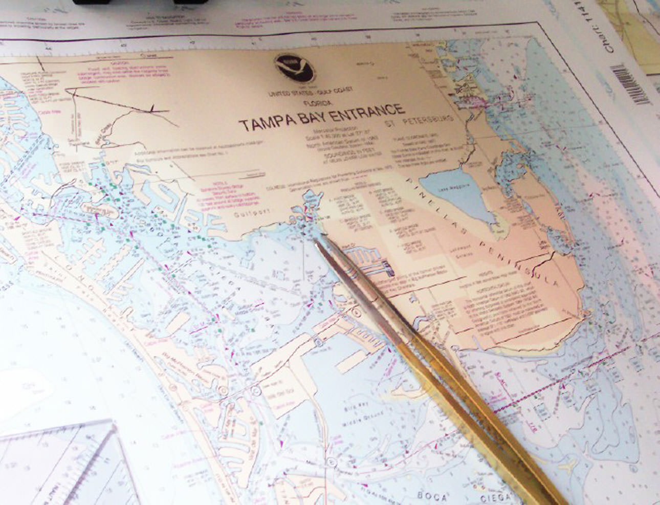 | ||
| A NOAA PAPER CHART, IMAGE COURTESY NOAA
Navigational forensic experts of the American Admiralty Bureau, Ltd have frequently described for American courts the standard of navigational accuracy for non electronic navigation. In terms of fixing position when navigating with magnetic compass, paper charts, parallel rules and dividers it is generally plus or minus 200 yards of true position. "True position" today may be determined within 50 feet or less using GPS. Unfortunately the value of knowing your "True Position" ( exact latitude and longitude on the face of the earth ) isn't of the same value at all times and in all places. Crossing a deep portion of ocean with no surface features and depths far beyond the deepest ship's draft there is little to worry about whether you are 200 yards off or less than 50 feet off. But in confined or obstructed waters, or waters transitioning from deep to shallow the tendency to crank up and rely on the GPS linked electronic chart display even when it is working to its most efficient performance can prove deadly. Despite the fact that mariners can now print out their own paper charts or dial up electronic charts "updated" to the day you print them out, there are hidden dangers. The new "updating" may alert you to the location or approximate location of new known obstructions but that is not enough to warrant the seemingly blind trust than many younger professional mariners put in electronic navigation. The GPS may show you on the chart your precise position in terms of longitude and latitude but you might be 200 yards nearer or farther off from that rock, shoal, shallow area, or beach line than your "updated chart " indicates.
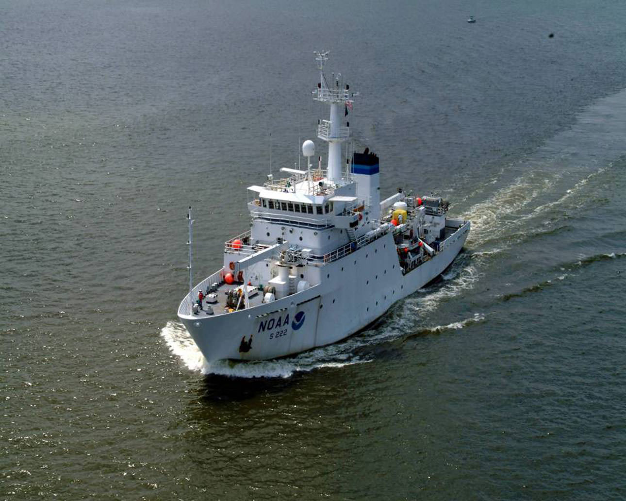
The "datum" on your navigation chart, unlike your own GPS generated position may be decades or even centuries old, and formulated using pre-electronic navigational systems. NOAA and the British Admiralty are working on improving basic chart datum like depths, bottom types, positions of land forms, rocks, etc.. But this is still slow time consuming work. The painstaking nature of updating basic chart datum is the one of the main reasons why NOAA maintains its Atlantic and Pacific Fleets of research ships, boats, and air craft. Satellites help but most often there has to be a survey ship visit to the sites incorporated onto navigation charts. Time, skills, professional effort, and serious expense are involved, the work is never finished, and tends to move slowly. The prudent mariner never fully relies on assumptions , if you can't verify the accuracy of your chart's under lying data, don't assume that your estimated proximity to navigational hazards is vastly improved by your electronically produced fix of position. You must always consider datum reliability in factoring safety margins. The older your chart datum, the less reliable it is, and the greater margin for error for safe passage you should allow.
Fortunately today , at least the new NOAA charts help you to estimate the reliability of datum. NOAA now marks its chart products with notations /diagrams on "ZONES OF CONFIDENCE" (ZOC) . The ZOC diagrams and notations address information on such datum as age of information , position accuracy, and seafloor coverage.
|
Navigation Systems Information
NOAA terminates the Chart Updating website
 |
| Nautical chart of Portuguese cartographer Fernão Vaz Dourado (c. 1520 - c. 1580), Public Domain Based on Age of Work (More Than 70 Years Since Death of Author) |
See Our Related Post THE UNDERLYING INACCURACY IN TODAY'S NAVIGATION
On April 19, 2016 the USCG Auxiliary Chart Updating Reporting Webpage (CUWeb)was shut down permanently. As was that of the US Power Squadron. NOAA cut off the links due to cyber security considerations. It was determined by NOAA that the two cooperative web sites facilitating access to the NOAA chart updating net work might allow hackers a backdoor route to gain access to government internal networks. NOAA does not intend to bring the sites back on line in the future, the cyper security issue only appears to be able to be secured by closing the NOAA connection. It looks like this is the permanent solution.
However at lest the Coast Guard Auxiliary reports that the closing of CUWeb does not spell the end to the Auxiliary Chart Updating (CU) program. The Coast Auxiliary feels that Chart Updating "still plays a vital role in promoting safety on the water." The Auxiliary will continue to teach chart updating methods. The Auxiliary notes .." The same information that was being provided through CU Web can still be sent to NOAA, however without the aid of the structured CU Web report format web page. Chart corrections and discrepancies can be submitted to NOAA through the Inquiry and Discrepancy Report System (IDRS)" at http://ocsdata.ncd.noaa.gov/idrs/discrepancy.aspx ".
It should be noted that all mariners may report observed chart discrepancies to NOAA @ http://ocsdata.ncd.noaa.gov/idrs/discrepancy.aspx
As noted in our post
THE UNDERLYING INACCURACY IN TODAY'S NAVIGATION The processes of gathering original "datum", updating, and correcting charts are still more labor intensive and slow than obtaining an accurate fix of position from the GPS system. That super accurate GPS "fix" will definitely show you your vessel's longitude and latitude with previously unprecedented accuracy. However, when you chart that position your proximity to navigational hazards may not be nearly so accurate due to the manual processes that still dominate the depiction of basic datum like coast lines, and navigational features, and updating such information on a regular basis.
OTHER NAVIGATIONAL VIDEOS:
How to update your ADMIRALTY Standard Nautical Charts
How did early Sailors navigate the Oceans? | The Curious Engineer
https://www.youtube.com/watch?v=4DlNhbkPiYY
How does math guide our ships at sea? - George Christoph
https://www.youtube.com/watch?v=AGCUm_jWtt4
Getting Started in Celestial Navigation (The Marine Sextant)
https://www.youtube.com/watch?v=DrAkrgZRb9Y
Find North with the Stars - Polaris & Ursa Major - Celestial Navigation
https://www.youtube.com/watch?v=n_gT9nBfhfo
Stargazing Basics 1: Learn how get oriented in the night sky for stargazing
https://www.youtube.com/watch?v=XUbG8jboh4M
Stargazing Basics 2: Understanding star magnitude in astronomy
https://www.youtube.com/watch?v=9P8Veb_AlJ0
Stargazing Basics 3: How to measure distance in sky to find other stars
https://www.youtube.com/watch?v=YMu5k3Ik7JU
Celestial Navigation, Stars Finding - G.T.Rude (2006)
https://www.youtube.com/watch?v=v7t-iQckrtg
Star Finder Chart
https://www.youtube.com/watch?v=LBTudir1Ymw
GENERAL INTRODUCTION TO CELESTIAL NAVIGATION:
https://www.youtube.com/watch?v=fn9xMkNUMmY
Celestial Navigation Math
https://www.youtube.com/watch?v=XWLZKmPU17M
In our NAUTICAL CLASSICS section we describe the role that these works play in the professional examination of Merchant Marine Deck Officers by the U.S. Coast Guard and their authoritative nature for a variety of other uses. For example if an admiralty Lawyer wanted to demonstrate to the court the degree of accuracy that may be ascribed to non electronic classic coastal chart navigation a citation to Chapman's would be considered "authoritative" if the issue was the degree of accuracy ascribed to classic celestial navigation Dutton's would be considered authoritative. This section is not about these authoritative tomes or specifically about preparing for the navigation section of a Coast Guard administered professional examination. This section is partly about the study of navigation for both recreational boaters or yachtsmen and professional mariners using contemporary and easier to read volumes.
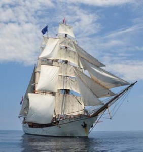
This section is also about the history and development of navigation and its impact on the world. Additionally we will examine books about the great navigational feats of history, and some of the suspected feats lost to history or preceding written history. Before the "Global Village" could be a possibility first there had to be a "World Community" and that was only possible with the ability to conduct long sea voyages and repeat them at will. That ability hinged on the marriage of three sciences. First the use of vertical airfoils known as sails had to be mastered to a point where progress could be made against the direction of the prevailing wind. Second hull forms had to be devised that could carry men, supplies and useful cargo in commercial volume to be driven by these sails. But even with these developments the resulting ships had to stay pretty much to coastal routes until navigation was further developed.
In the Northern Hemisphere navigators had discovered that the "North Star" (Polaris) could be relied on to determine latitude. The angle between Polaris and the visible horizon on a clear night was almost exactly equal to the ship's latitude. Thus using "latitude sailing" by the time of Columbus ships could leave Spain or Portugal sail out of sight of land along a given line of latitude and return along that same line to a coast line where they could use traditional coastal piloting methods to get back to their port of origin. The system was reliable enough to colonize the CANARY and AZORES Islands. But it was an inefficient system. Once a ship on a latitude sailing had put its stern to the mainland of Europe or Africa, it could only estimate its longitude by crude measurements of speed such as the Tariff Rail Log and apply the time, speed, distance equation for a very rough estimate of its longitude. Fog or rain often lead to running aground or on the rocks at one's destination. If your helmsman was a little off you might pass the Azores in the middle of the night and keep on going for quite some time before suspecting what had happened. Things were pretty inexact until the invention of the Chronometer and a system for a more precise determination of longitude which opened the globe to more direct and reliable sailing routes. But on nothing more than latitude sailing Columbus discovered the Americas and was able to repeat his voyages.
In the centuries that followed Columbus there emerged the great European recognizance of the planet, followed for better or worse by the colonial era. Long before the invention of the steamship great sailing ships linked the far corners of the globe transporting visitors, cargo, ideas, news, knowledge, languages, pests and pathogens to the far corners. A commercial voyage to China from the United States, or from England to Australia may have taken months but it could be done at will and repeated and at considerable profit. Thus there was a global community awaiting the development of jet travel and electronic communications to evolve into the "Global Village" of today where everybody knows what's happening everywhere in virtual real time.
However, the contributions to human civilization of navigation are not all in the past. Man's first attempts to fix his position upon the face of the Earth far from any land marks involved looking to the stars. What we learned in sea navigation was quickly applied to aerial navigation. The techniques that mariners developed in relative motion plotting and prediction to aid in collision avoidance in crowded waters were useful to air traffic control and eventually to astro navigation, our ability to find our way through outer space.
In this section we will look at navigation in its entirety, not just as a professional mariner's examination subject. The study of navigation, especially its history is a unique window and perspective on world history. In studying history through the eye of the navigators we gain a unique perspective not only on the history of civilization but also a window into our future as a species.
Consider for a moment that environmental problem that is still in progress, "The Colombian Exchange." This was an unplanned and unanticipated consequence of linking the globe by ship that we still suffer from. Those great food stuffs corn and potatoes spread around the world, but so did the Norwegian rat. Today we call this continuing exchange of plants and animals intended and unintentional the "Colombian Exchange." Where the Colombian exchange brings destructive pests be they Zebra Mussels, Fire Ants, Walking Catfish, or Kudzu vine we call the resulting set of problems "exotic intrusion." We are spending billions of dollars trying to get the problems of exotic Intrusion under control and we are a long way from making that happen. Shouldn't we take a lesson from this when we look at returning samples of soil and other things to earth from other planets? Yet if you are as old as I am you have a memory of watching television as a retuning space capsule sank to the bottom of the sea. There are plans afoot even as I write this to gather samples of Martian soil and return them to earth for analysis. Has anyone asked just how tight the sanitary protocols are for such a venture? The first life that we are liable to encounter out there is highly likely to be microbes. The lesson of the Colombian exchange is that if we don't want massive destructive results on the order, or worse than, the on going Colombian Exchange we had better take a lesson from our global maritime history.
Indeed simply making the public more aware of history from a maritime perspective could greatly influence our approach to space exploration. If we start to think of space as an ocean and start to look at oceanic history from both Western and Non Western views some unique insights into the future development of our solar system emerge. Consider what was once thought of as the "uninhabited islands" of the Polynesian peoples. Recent discoveries of the role of the "Pilot" in Polynesian society reveal that most of these islands which lacked sufficient fresh water to support villages were nonetheless farmed, gathered from, and fished around by villagers from not so nearby inhabited islands. The relatively large populations of these islands depended in part on produce, crops, and fish from these uninhabited out islands reached on a regular periodic basis by large voyaging canoes navigated by "Pilots." These "pilots" had created a unique and largely non mathematical system of navigation sufficient to hit tiny islands out of sight of land at will on a regular basis. The outer uninhabited islands in fact belonged to the inhabited islanders who regularly exploited their resources.
Now think a minute; as our population expands and space travel becomes more developed might we not add to our global larder from the uninhabited planets of our solar system? Indeed if there are other space faring intelligent species out there might they have already established a galactic law that ascribes ownership of the outer planets of a given solar system to the intelligent inhabitants of any inhabited planet in the same system? If that is the galactic legal regime then throughout our history, no matter how many times we may have been visited by extraterrestrial aliens, it would have been unethical and probably illegal for them to establish fixed bases of any sort on our "outer islands." Based on the lessons in Polynesian "real estate law" discovered in the study of Polynesian non mathematical navigation, we find a model of potential or even preexisting galactic law. Surely once an intelligent species achieves mastery of the ocean of space their view of their home world has to closely approach that of the ancient Polynesians. They evolved on a tiny island in the world ocean, not every island is inhabitable but most have resources of some use. In the ocean that the Polynesians occupied there were other peoples. Some sense of who had what rights to certain places had to evolve. Polynesian society is as close of a parallel to an advanced space faring society that we are able to study without leaving the earth. In that society the pilot or navigator wasn't king, but he was the most highly regarded professional.
That is certainly not the case for the professional mariner of Western Society today. That begs the question, are we really ready to head out there? We have so many unlearned lessons from our experience with navigation. The study of NAVIGATION isn't just an interesting hobby or a professional requirement. The study of the history of navigation and of history through a navigational perspective is of cosmic consequence. Do we repeat the errors of the European recognizance or avoid them? If most of the people in power don't even know what those errors are, how we will ever move out into space without subjecting ourselves to a repeat of the consequences of the Colombian Exchange which included wars, famines, disease, exploitation, all manner of human misery, and the continuing problem of exotic intrusion, along with an explosion of knowledge and the evolution of a global community.
American Admiralty Books is pleased to present NAVIGATION. One of our on going projects is called "Ben's Tech Spot". When ready this "spot" will precede our book reviews and listings. Ole "Cap'n Ben" in reality is a young seagoing officer who is hyper tech savvy and shares his tips on electronic navigation and related subjects in his "tech spot". Here you will find not only discussions of the proper use of ECDIS, ARPA, and AIS and other electronic navigational tools , but also written directions and useful hyperlinks that will help the navigator, professional or amateur to evolve his or her personal wireless lap top computer into a powerful navigation and voyage planning tool in its own right. Like all parts of the blog to date, NAVIGATION is under construction, a work in progress and a very big area that we will be quite some time in finishing. Please come back often.
Recently we discovered a high level of visitor interest in the related subject of cartography. If you've entered here looking for CARTOGRAPHY information Scroll down until yo see the heading CARTOGRAPHY
Ben's Tech Spot
Ever notice how some things in the Maritime Technology world advance at a lightening pace while others are locked in a time capsule? A perfect example is some Global Maritime Distress and Safety System (GMDSS) equipment still runs on DOS based software. DOS is a software system from the 80s! Remember having to type commands in command windows before the time of point and clicking with a mouse! While some aspects of Maritime Technology have been locked in time or are released years after the shore side equivalents are released to the public, there are some cool new tech tools that every mariner can take advantage of.
Internet at sea is becoming more and more available for both day sailors and the professional mariner alike. Internet at sea brings with it a whole slew of new and exciting tools that can help with planning, safety, navigation, weather, and communication. Many near coastal sailors are now able to simply tether their smart phone to a laptop and get real time weather updates, check vessel traffic, and even broadcast their AIS or positional information to free traffic servers so shore side family and friends can keep track of them along their voyage.
Many links in today's blog are my short list of new cool technology and resources as well as some tried and true links that every mariner should know. Even if you aren't able to surf the web at sea, many of these links are great planning tools and software that can be used underway regardless of web access or not.
Weather
Most Mariners are familiar with NOAAs weather forecasts available on most marine radios or many go to www.weather.gov to get NOAAs near shore and off shore forecasts. NOAA has some other great links that aren't as well know.
National Data Bouy Center's Interactive Buoy Map
NDBC has an interactive Google Earth Map that has real-time information from a world wide array of meteorological buoys. Simply find a buoy, click on it, and get real-time info about wave height, wind speed and direction, sea and air temp etc. It's a great tool to compare what the forecasters predicted and what is really happening along your route or at your destination.
NOAA Current Forecasts
For worldwide current forecasts point your browser to the above address. This is another great tool for voyage planning. Want to take advantage of the loop current or avoid it, simply take a look at the current models for the region you will be sailing in.
Just as we should never rely on any one form of navigation alone, never put all weather forecasting faith in any one group or forecaster. Here are some other great weather forecasting sites to use and compare.
Weather Underground
A great site that is good to use for their Sever Weather section. During hurricane season, check out the "Compiled Model". Usually a hurricane forecast is the average of a bunch of different models that forecasters have developed over the years. They usually will average these or pick the route that most of the models seem to follow to use in their hurricane track forecast. Wunderground's compiled model lets you do the averaging by showing you all the major models prediction of the storm path.
WEATHER NERDS .Org. http://www.weathernerds.org/
A meteorological tutorial site covering a variety of subjects including how to understand "Spaghetti Storm Tracks.
Storm Surf
A forecasting site that was originally designed and used by surfers. In some parts of the world these forecasts have proven to be more accurate than local models. Easily find wind, surf, and sea forecasts for select regions of the world. A must have site for any surfers out there.
SailWX
SailWX is a great little site that has real-time meteorological observations from ships all over the world. Any ship that is a member of the Voluntarily Observing Ship (VOS) program is listed on the site. While the interactive map isn't as user friendly as some of the other sites it is still fairly easy to navigate. Simply click on a ship on the map to get real time observations for any meteorological readings the ship is reporting. The site is a great little "Ship Tracker" site that has a very high number of ships participating. Chances are if you're on a cruise ship, oceanographic ship, tall ship, or container/cargo ship, you're on the map. The site also has tide and current predictions.
Sunrise/Sunset Calculator
Google Map page that provides Sunrise Sunset calculations for any point on earth. Simply click on a spot on the map and get your calculations.
XM Weather
For anyone wanting real-time weather information and forecasts but don't have a weather fax or internet at sea, SiriusXM has the product for you. XM WX Marine Weather is a program that uses the XM Sirius Satellite system to broadcast weather products to your laptop. Coverage is for the majority of US waters. I'll provide a more detailed review of the Master Mariner version of the program later.
Automatic Identification System (AIS)
AIS is a technology that has propelled the bridge of ship's light years ahead. AIS is an automatic tracking system used by ships and vessel traffic systems for reporting a vessels identification and basic navigational information. It's a standard used throughout the world on vessels 300 GT and greater. Many smaller vessels have been equipped with AIS transceivers as well due to its benefits. The cost of AIS has come down considerably. As anyone who sails with AIS know it makes instantaneous identification of other vessels a breeze. Simple turn on your AIS overlay on your basic navigation software and you instantly see all reporting vessels around you. You can quickly get their name, navigation status, position, course, speed, as well as basic voyage information. Most navigation programs are able to overlay AIS contacts directly on the chart.
Since AIS information is free and can be received by anyone with a receiver there has been a push to unify and establish an online AIS system available to all for free. A few sites have tried to do this. One that seems to be way out front is http://www.marinetraffic.com This website uses a Google Earth map to display a large world wide database of real-time AIS information. Basically anyone with an internet connection and an AIS receiver can submit their data to a central server that Marine Traffic then uses. Marine Traffic has by far the largest network of receivers all over the world. It's nothing for the site to be tracking over 50,000 AIS contacts at one time throughout the entire world! The site does a great job of displaying them and making them interactive.
You can simply click on a ship on the map and get its most current information as well as see pictures of the vessel. Marine Traffic has one of the largest collections of ship photos I have seen. Most appear to have been uploaded by the general public.
Marine Traffic also lets you embed their AIS map directly into your webpage, has mobile apps for both iPhone and Android, as well as a really nice Google Earth overlay kml. Anyone with that wants to set up a base station can follow the directions on their site and begin adding to the overall coverage. There are even instructions on how to build an AIS receiver using a old marine radio!
OpenCPN
Is a great free open source navigation program that is by far the best on the market today. A quick google of "Free navigational program" quickly shows you the lack of programs out there that are really free. Most of the free ones out there are old and outdated as well as fairly buggy. OpenCPN has a great following and its open source code allows for others to develop addons. So the feature possibilities are fairly limitless. It already has AIS integration and can even accept a networked GPS feed. It can display both Raster and ENC Vector charts, is light weight, quick, and clean. Developers are currently working on a radar overlay function as well. Why spend hundreds on the name brand software packages when OpenCPN does almost everything they can for free.
COUNSEL ON FOREIGN RELATIONS: A Backgrounder on the Big Picture Concerning the Global Resurgence of Piracy: http://www.cfr.org/france/combating-maritime-piracy/p18376
PIRACY: A Daily Update on activity :http://www.icc-ccs.org/piracy-reporting-centre/live-piracy-report Piracy has to be once again be seriously considered in voyage planning
. The ICC Commercial Crime Service provides maps of pirate activity, advice to masters, instructions on reporting incidents , precautions etc. a great voyage planning tool for any long ocean voyage and an absolute must off of parts of Africa, south East Asia and South America.
U.S. State Department Piracy Fact Sheet
http://travel.state.gov/travel/cis_pa_tw/piracy/piracy_4420.html
U.S. Maritime Administration , Piracy and Physical Security
http://www.marad.dot.gov/news_room_landing_page/maritime_advisories/advisory_summary.htm
U.S. Department of State World Wide Cautions
http://travel.state.gov/travel/cis_pa_tw/pa/pa_4787.html
SECURITY INFORMATION IN CHART FORM: The United Kingdom Hydrographic Office (UKHO) has announced the introduction of two new Admiralty Maritime Security Charts to cover The Mediterranean (Q6111) and The Persian Gulf (Q6110). The two new paper charts, together with a new online update service, provide a simple, single point of reference for the most up to date security information to make passage planning safer. The new Maritime Security Charts are designed to be updated by ship personnel or shore-side security managers with information that represents a risk to the security of navigation. This includes data on piracy, terrorism, mine warfare, embargo, illegal fishing and exclusion zones, as well as routeing and reporting requirements implemented by military or security forces.
This information can be accessed via a new Admiralty service, Security-Related Information to Mariners (SRIM), available free via a dedicated website. SRIM provides only official information which has been validated at government level. It is collated by the UKHO through its work with NATO and government-to-government organisations, ensuring the most accurate and timely official information is available to mariners and shipping companies.
www.ukho.gov.uk/security.
The Exclusive Economic Zone (EEZ) and The Right of "Innocent Passage"
Another area where voyage planning is becoming more complex is the crossing of other nations Exclusive Economic Zones (EEZs). It is important to know when you are in these areas and to abstain from certain activities such as fishing, trailing sensors, having certain types of sensors on, physical contact with small craft, etc. The link above can aid you in determining when you will enter EEZs. http://geoboundaries.

One of NOAA's handiest navigation products, especially for recreational boaters, has been Coast Survey's experimental BookletCharts™ -- nautical charts that are easy to download and print from home computers. Coast Survey has now moved the BookletCharts from experimental stage into official production. Nearly a thousand newly updated BookletCharts are available free on the Web.
NOAA's new official BookletCharts cover the 95,000 miles of U.S. coastline and the Great Lakes. The BookletCharts contain most of the information found on NOAA's full-scale nautical charts, but it is presented as reduced-scale.
"It is especially appropriate that we unveil these easy-to-use nautical charts as recreational boaters begin to think about their boating adventures for 2013," said Capt. Jon Swallow, chief of NOAA Coast Survey's Navigation Services Branch. "NOAA's nautical charts help to protect lives and property, and boaters should take advantage of these free nautical products."
"Many boaters don't use nautical charts, trusting local knowledge or their memories. But that can be dangerous, as seafloors constantly shift, shorelines erode, and dangers to navigation are discovered," Swallow said. "BookletCharts will tell a boater about these developments, and will help ensure a safe voyage, whether it is around the bay or down the coast."
Since the Booklet Charts are easy to access from the Web, easy to print, and easy to carry in a pocket, NOAA officials hope that tens of millions of recreational boaters who may not normally use charts will use these.
Several years ago, the Office of Coast Survey introduced experimental BookletCharts as PDFs in an 8½-by-11 inch format, to test public demand and use. The product has been tremendously successfully, receiving kudos by recreational boaters and boating organizations. Coast Survey has subsequently upgraded the chart displays and navigational information for the official product.
While BookletCharts are great for recreational use, they do not fulfill chart carriage requirements for regulated commercial vessels under Titles 33 and 46 of the Code of Federal Regulations.
NOAA's Office of Coast Survey, originally formed by President Thomas Jefferson in 1807, updates the nation's nautical charts, surveys the coastal seafloor, responds to maritime emergencies and searches for underwater obstructions and wreckage that pose a danger to navigation. Follow Coast Survey on Twitter @nauticalcharts, and check out the NOAA Coast Survey blog at http://noaacoastsurvey.wordpress.com for more in-depth coverage of surveying and charting.
NOAA’s mission is to understand and predict changes in the Earth's environment, from the depths of the ocean to the surface of the sun, and to conserve and manage our coastal and marine resources. Join us onFacebook, Twitter and our other social media channels.
AMAZON's CHARTS and MAPS SHELF
AN IMPORTANT VOYAGE PLANNING AND PORT ENTRY PLANNING RESOURCE

Steamer Sequens entering harbor, Kołobrzeg, Pomerania PD Library of Congress
SHIPPING GUIDES: An Information Source About Ports And Port Entry Requirements. Publishers of the SHIP'S ATLAS A Useful Navigation Bridge Reference At Voyage Planning Time And At Landfall Planning Time.
Here is a complete description of of their fee based services and products from their web site: http://www.portinfo.co.uk/about-us
Here is a link to their free online links to port operated websites around the world http://www.portinfo.co.uk/port-websites
.............................................................................................................................................................................................
BOOKS
............................................................................................................................................................................................EARLY MAN AND The OCEAN: A Search for the Beginnings of Navigation and Seaborne Civilization, by Thor Heyerdahl
ISBN 10:03947422184
ISBN 13: 978-0394742182
You probably thought that we'd start
out with "Navigation for Dummies" and we will eventually get to the how
to navigate books; and, as is our custom, we'll start with the most simple
and work to the more complex and specialized. However, as noted, we know that
our professional mariner readers are highly motivated to study navigation
because the minimum passing grade on the Coast Guard professional examinations
in navigation is 90%. If you are not a maritime professional, and brand
new to the idea of studying navigation, we want you to get excited about the
subject. We want to share with you our view that navigation is one of the
pillars of civilization and a subject of cosmic consequence. If you are a
professional mariner we want you to become an "apostle of navigation," able to
explain to the land lubbing public the cosmic importance of navigation and the
utility of a "navigationcentric" view of world history.
When one finally knuckles down to the actual study of
navigation it is mostly math, perhaps the most important practical application
of math in human history, but number crunching all the same. Many people who
need to study navigation are put off by math. In our humble, but usually close
to infallible opinion; we think the vast majority of people on this planet need
to understand navigation as a pillar of civilization and a unique and
important historical perspective. This is so even if they never learn
the math to correct or uncorrect compass error, plot a course and correct for
set and drift. Even the most dedicated land lubber votes. Don't send
people into public office who are clueless on maritime
matters.
Excuse me, let me remove this soapbox so I can
pontificate on the book at hand.
This work by Thor Heyerdahl takes some of the theories
he described in KON -TIKI and
AKU-AKU and explains them in a unified and coherent
whole. Polynesia and the America's as far as we are able to tell at the moment
left us no written reasonably accurate pre-Colombian history. Theories of how
these vast regions of the world came to be peopled abound. The one unavoidable
fact that all such theories must address is the separation of the regions by
vast expanses of ocean. People of a certain age are familiar with the old
simplistic explanation of the peopling of the Americas by Asian peoples who
crossed a land bridge during the ice age that ended about 10,000 years ago. But
genetic evidence now coming to light as well as historic observations indicate
that the Americas and Polynesia weren't peopled in one wave or by a single
people. Within Native American genetic make up we find common elements with
Asian, Polynesian, and European peoples not in the same proportions every
where. Indeed genetic evidence is tending to disprove some of Thor Heyerdahl's
theories described in this book. None the less Heyerdahl's is an important
thinker and researcher in this realm. While Hyerdahl's observations about
kindred technologies and customs among seafaring peoples of the Pacific basin,
including the West Coast of South America, may not hold water in the light of
more precise genetic information available today; modern genetic based research
is demonstrating the essential correctness that the pre-Colombian peoples of the
Americas and Polynesia are not of a single origin. Heyerdahl's processes of
examining and testing ancient technologies may well prove to be a critical
element in understanding the arrival points and spread of the pre-Colombian
peoples.
The process of peopling the Americas and Polynesia involved non western seafaring technologies and navigational practices. Two things are clear since Heyerdahl began writing; Polynesian seafaring technology involved a highly sophisticated form of basically non mathematical navigation and vessels consisting of multiple hulls or even sailing rafts. In the case of the multi hulls we are only beginning to understand the enormous utility and potential of this hull form. While certainly not a requirement, or even an American Admiralty Books "recommendation" or official "suggestion" there are far less entertaining and informative ways of beginning or expanding a study of navigation than by reading the works of Thor Heyerdahl. Don't reject these works based on the genetic information not proving out his specific "peopling" theories exactly. The value here is in his process of studying ancient technologies and the future value in that technique is in identifying initial points of contacts and the spread of and eventual fusion of technologies, languages, and people into something new.
.............................................................................................................................................................................................
KON-TIKI: Across the Pacific by Raft by Thor Heyerdahl
ISBN 10: 1602397953
ISBN 13: 978-1602397953
This was the book that started it all,
not just the other works by Heyerdahl but the whole anthology of volumes that
have come out ever since on the research, speculation, and legends of the
peopling of Polynesia and the Americas by ancient seafaring people crossing the
trackless Pacific back and forth with maritime technologies and navigational
techniques radically different from those of the West. Heyerdahl formed his
theory that parts of Polynesia were populated by ancient fishermen and seafarers
from coastal Peru, then set out to prove it. Nine forty foot balsa logs,
hundreds of fried flying fish dinners, and months later Heyerdahl and five
companions crash landed their raft on an inhabited Pacific island, proving at
least that it was possible that pre Colombian Peruvian
coastal fishermen could have survived a lengthy Pacific transit on one
of their fishing rafts. The accurate story of how the Pacific and the
Americas, particularly the West Coast of the Americas were actually populated,
remains to be completely pieced together but the voyage of the
KON-TIKI put to rest the idea that one origin explains all.

.............................................................................................................................................................................................
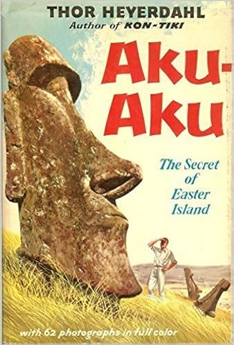
AKU-AKU by Thor Heyerdahl
ASIN
B00009ESXQ-paper back, some hard bound also available
This is Thor Heyerdahl's exploration, and attempted
explanation, of some of the mysteries of Easter Island, particularly the stone
carvings and the caves.
.............................................................................................................................................................................................
The RA Expeditions by
Thor Heyerdahl
ISBN 10: 00457202207
ISBN 13-978-0045720200
After the discovery of some Egyptian
coins and pottery in an archeological dig in South America and a visit to North
Africa where he witnessed the making of some vessels out of papyrus reeds that
strongly resembled some vessels fashioned by South American Indians for service
on certain lakes, Heyerdahl theorized that ancient Egyptians made it to South
America thousands of years before Columbus. Heyerdahl, being Heyerdahl had a
similar vessel built in North Africa and attempted to cross the Atlantic. About
27000 miles later and short of land fall the craft had to be
abandoned.
Using Indian builders on a second craft the second
RA made the crossing from Morocco to Barbados in 57 days in fine shape. Why were
there pyramid building cultures in Central and South America as well as North
Africa? Who can say? But the fact that a papyrus vessel could cross the
Atlantic, even if only once and by accident, would explain the presence of
Egyptian coins and pottery in a dig of ancient Meso American ruins. The
survival of the second Ra and the coin and pottery evidence strongly support at
least one, one way voyage. The parallel pyramid building propensity might
indicate two way contact for a while, but then other things could explain it as
well. The jury is still out on the net North African contribution to the gene
pool and culture of the Americas. A one way voyage is an easy accident to
explain, two way traffic would indicate a level of navigational development
previously unsuspected in the Egypt of 2300 years ago.

The RA EXPEDITIONS
The.........................................................................................................................................................................................
Fatu-Hiva:Back to Nature by Thor Heyerdahl
This is hardly a navigation book, it's actually more of
a honeymoon narrative. Nonetheless one can hardly mention Thor Heyerdahl
without describing this book. It was during his year and half
honeymoon on the idyllic island of Fatu-Hiva in French Polynesia that Heyerdahl
first picked up on the native belief that the population of this island
originated "from the East," the only landfall east of Fatu-Hiva is South
America.
NAVIGATION THROUGH THE AGES by
Donald Launer
ISBN 10:1574092782
ISBN 13: 978-1574092783
This is a general history of navigation from ancient
tools like the astrolabe, quadrant, and cross staff with a nod to the ancient
Polynesians and a detailed look at the search for a reliable way to compute
longitude. The book takes the reader up to and through a considerable part of
electronic navigation as practiced in the 21st century.
..........................................................................................................................................................................................
3 for Free, An Amazing Kindle Bundle for the Serious Student
of Navigation History
- THE PRINCIPAL NAVIGATIONS, VOYAGES, TRAFFIQUES and DISCOVERIES of the ENGLISH NATION, Vol.01 by Richard Hakluut
- LECTURES in NAVIGATION by Earnest Gallaudet Draper
- CAPTAIN COOK's JOURNAL DURING THE FIRST VOYAGE by James Cook
These three books are available
FREE in their Kindle
editions. See our blog "Naval Interest: Lighting the Back
List "http://
blogspot.com/2012/02/lighting-
..........................................................................................................................................................................................
Before we leave navigation history for actual
navigation "how to" texts we need to visit the ancient Polynesians and their
unique system of navigation that is so different from the western mathematical
model. Keep in mind that the NAVIGATION section, like the rest of the blog is
under construction. There are many more books on both navigation history and
navigation techniques that we have not described for you yet. Right now we are
trying to give the reader a light sampling of the types of publications that you
will find in this section. Check back often for updates.
------------------------------
WE THE NAVIGATORS: The Ancient Art of Landfinding in the
Pacific by David Lewis
ISBN 10: 082481583
ISBN 13: 978-082415820
My Cajun relatives used to scare the
liver out of the 1960s era Coast Guard Campache Patrols. I was on active duty
with the Coast Guard at the time and whenever we'd find Cajun shrimp fishermen
off of the Campache flats of Yucatan and board them my Commanding Officer, the
Executive Officer, the Navigator and all of the Quartermasters would be shaking
their heads for days. How on earth did fishermen from Louisiana, with no
knowledge of celestial and electronic navigation, often with outdated and
inadequate charts, get from the coast of Louisiana to the flats off Yucatan and
return home to their tiny home ports on the Louisiana coasts. How could they
navigate without instruments? Being a native I understood. They knew that
Yucatan was about 600 miles south of Louisiana and about 500 miles wide, a big
target. They weren't looking to make a particular land fall just looking for a
change in the water color from inky blue to turquoise which signaled the arrival
on fishing grounds that our ancestors had fished since French and Spanish
colonial times. So with, or without compass, regardless of its state of
repair, or availability of correction tables you determine which way is south
and head out insuring that any course deviation from dead south is in a westerly
direction and away from those pesky Cubans.
Arrival on the banks, was signaled by the dramatic change in water color. Most of the time the fishermen had little understanding of where they were other than about 12 miles off the Mexican coast of Yucatan with little clue to their longitude. When the hold was full of iced down shrimp from wherever you were, you pointed the boat due north and tried to keep any steering off of due north to the west, again trying to stay out of Cuban waters. Eventually you had to hit the Texas or Louisiana coast line, familiar turf where you could navigate by land marks home. By the 1960s there were new landmarks, oil rigs in dense profusion off the coasts of Texas and Louisiana. As soon as our fishermen saw a rig they would pull up close and look at the Minerals Management Service lease number displayed by sign on the rig. They then knew exactly where they were and could scurry back to home port. Today Cajun fishermen just buy GPS receivers like everyone else but this is their fall back technique.
By contrast the ancient Hawaiian "pilots" had to leave little pin points of land in one part of the vast Pacific and hit specific pin points often dozens, frequently hundreds and sometimes thousands of miles away. There is evidence of regular contact between Tahiti and Hawaii, thousands of miles apart. The Kings of Hawaii had to communicate on a regular basis with islands in a chain nearly a thousand miles long, many of the islands not in sight of each other. All over Polynesia outer uninhabited islands were being farmed, gathered from, and fished on a routine annual cycle by workers delivered to the islands by the venerated Polynesian "pilots." Unlike my Cajun relatives, their navigation without instruments, or much in the way of math had to be pin point accurate. The ancient Polynesians weren't trying to get from a 450 mile wide coast line to a 600 mile wide fishing bank they either reached the targeted island or sail off into a boundless sea where their chances of survival were not good. This is an excellent book to give the reader a general introduction into the World of the ancient Polynesian "pilots." The hyperlink will take you to copies priced under $20. The ISBN numbers will assist you in finding a library copy, but no study of navigation is complete until you achieve some understanding of the incredible navigation of the Polynesians.
VAKA MOANA-Voyages of the Ancestors: The Discovery and
Settlement of the Pacific by K.A.Howe
ISBN 10:0824832132
ISBN 13:
978-0824815815820
This is a hard bound and illustrated
and very comprehensive description of the peopling of the Pacific by voyaging
canoe and the stitching together of a loosely affiliated but surprisingly
cohesive culture that spread across an area larger than the United States but
with each human settlement separated by dozens, hundreds or thousands of miles
of open ocean, routinely traversed buy intrepid mariners led by intrepid
"pilots" using a highly complex instrument less form of non-mathematical
navigation. In the migration of the human species from the plains of Africa to
the far reaches of the planet the lands settled by the Polynesians were the
places that no one could walk to. Yet their settlement doesn't follow an
accidental pattern. The Pacific, when Captain Cook arrived, was
peopled by a loosely bound but communicating culture able to visit across
thousands of miles of ocean. This version of the story runs about $42. It
was temporarily out of stock at Amazon when we checked on February 19,
2012
.........................................................................................................................................................................................
So now we'll try to give you a sampling of "how to"
Navigate books. We normally like to start with the simplest and run to the more
complex. But we already opened this section with a discussion and links to the
classics in "how to" navigate books that form the data base for the Coast
Guard's professional examinations in navigation. So just in case we have to take
a long pause in completing the navigation section due to pressing business in
other sections the American Admiralty Book elves will close out today's
production with a comprehensive guide to non instrument navigational techniques.
Check back in with often, don't get lost.
-----------------------------------------------------------------------------------------------------------
EMERGENCY NAVIGATION, 2nd Edition Improvised and
No-Instrument Methods for the Prudent Mariner. by David Burch
ISBN 10: 00714818442
ISBN 13: 978-0071481847
American Admiralty Books:
Recommended
The author David Burch is the founder of the well
respected Starpath School of Navigation. What he calls "improvised" or
"emergency", or "no instrument navigation" is touched upon in the some of the
older editions of the "Blue Jackets Manual" as "Lifeboat Navigation."
On even the best equipped vessel things get broken, malfunction at the worst
possible moment, get wet, even go up in a puff of smoke. Murphy's law that
anything that can go wrong eventually will, and usually at the worst possible
moment, applies in spades at sea. so what do you do when you weren't born into
an ancient Polynesian pilot clan and your GPS burns up, all your charts get wet,
and you find yourself on an instrument less vessel or life boat. Well, if you
read Dr. Burch (Ph.D. in Physics), you'll know how to steer by sun, stars, wind,
and swells. At a little over $15 bucks this is probably a book that every
mariner ought to have for their professional or hobby library. It was well
received by Boat US which is very interested in maritime safety and loss
control, they are about as close as you can get to the "Good Housekeeping Seal
of Approval."
.........................................................................................................................................................................................
HOW TO READ A NAUTICAL CHART: A Complete Guide to the
Symbols, Abbreviations, and Data Displayed on Nautical Charts.
by Nigal Calder
by Nigal Calder
240 pages
ISBN 10:0071376151 ISBN 13: 978-0071376150
American Admiralty Books:
Recommended
A "Chart" (vice "map") is used to navigate at sea.
Charts are published by such organizations as the British Admiralty
and America's National Oceanic and Atmospheric Administration (NOAA). Up
until the year 2000 NOAA used to publish a small booklet
titled "Chart NO. 1" which provided an illustrated guide to
the symbols used on NOAA charts. The government stopped printing "Chart
NO.1" in 2000. This book is more than a simple commercial replacement for Chart
NO. 1. If that were all that it was meant to be there would be no need for 240
pages.
The British Admiralty predates Captain Cook and the little known NOAA Corps, the uniformed para-naval officers of NOAA who command the charting ships and aircraft, and provide diving and other dangerous field research services are thought to date back to the Louis and Clark expedition. Our point is not to trace charting organization history but to point out that global charting has been in progress for centuries. Each generation of charts builds upon the work of previous surveys. But progress is not universal or steady, priority goes to the most important commercial routes. In the Pacific during World War II some remote islands hadn't been recharted since the days of Captain Cook.
Over the years not only do landmarks and land forms change but so do navigational survey methods. In the nineteenth century most navigational methods were accurate down to about plus or minus 200 yards, especially where few landmarks were available. In the twentieth Century more accurate electronic methods became available culminating most recently in GPS and laser ranging methods of extreme accuracy. Unfortunately few navigational charts available today are based on a new GPS/Lazer ranged gross survey. The latest depth contours, navigational aids, and land marks may be arrayed on a basic chart background based on survey of ten to two hundred years in age and performed to what would now seem very gross standards of accuracy. This is why we still have a NOAA Corps and their work never stops. We may well be one hundred years before the world's ocean and coastal charts are based on the latest standards of accuracy with entirely new chart overlays. For now the differences in charting accuracy in positioning important but impermanent chart features make for a real mixed bag of reliability of information. One of the most common problems is what happens when the charting authorities place a new land mark or aid to navigation on an old shoreline contour. The new feature probably had its position determined by GPS and/or laser ranging and the position by latitude and longitude is dead on accurate. Now when the charting authority goes to plot the new feature on the chart it is placed per the new exact latitude and longitude but on a shore contour that is aged and possibly only accurate to plus or minus two hundred yards. This can make a daymark that is set back from a beach look like it is set in a nearby mangrove marsh on the chart.
Folks who navigate by GPS on NOAA and similar ocean and coastal charts need to understand these potential chart inaccuracies as well as how to simply read a nautical chart. This book is a bargain in our opinion at a little over $14. While the basic explanation of chart symbols is not unlike material contained in Chapman's Piloting Seamanship, and Small Boat Handling which every recreational boatman and sailor should have, the explanation of the types and origins of modern charting error are difficult to find anywhere else, including many Coast Guard Auxiliary and U.S. Power Squadron navigation courses. Some critics have complained about the length of the book compared to Chapman's coverage of the same subject, or Nautical Chart No. 1. But the reader doesn't have to read the entire work in one sitting. The Chart symbols can be mastered as easily as ever, as your study of navigation increases and your goals of accuracy increase the rest of the book will become more valuable.
If your boating takes place on certain inland waters the "Charting authority" may actually be the U.S. Army Corps of Engineers and the "Charts" are called "Flood Control and Navigation Maps. The Army publishes its own guide to "navigation map" symbols that they use. Some large inland impoundments are not "charted" or "mapped" by any federal authority and the only available "charts" are "fishing guides" and "lake guides" which follow many of the conventions of nautical chart construction but usually carry a warning that the "map" is "not intended for navigation." Of course there is no other source available, the private map maker is just protecting himself from the potential liabilities in charting error that can occur in such endeavors similar to the problems emerging now in the vast world inventory of ocean and coastal charts due to changes in geographical survey technology and the sheer amount of field work that it takes to create a useful "chart." The knowledge gained in these 240 pages will beneficial to the navigator when venturing into any sort of strange waters regardless of the producer of whatever "Charts" or "navigation maps" as are available. Dealing with varying levels of chart inaccuracy is part of the art of navigation, just as the time, speed, distance equation is part of the science. Even if you are a very experienced commercial navigator, if you have not considered seriously the sources and effects of chart error, perhaps because of long operations in familiar and well charted waters; we urge you to get this book. If you are a new navigation student charts will be a part of every navigational skill that you will learn from coastal piloting to celestial navigation and electronic navigation. This book is a great place to start. and a reference that you will use for a lifetime.
.........................................................................................................................................................................................
HOW TO FIND PRACTICE CHARTS:
Once you learn how to read a navigation chart you may want to practice chart table navigation on a chart of your intended cruising grounds. But if you are studying for the navigation section of one of the Coast Guard examinations we suggest that you use the official practice chart. If you ar ein the market for actual navigation charts we strongly suggest a telephone consultation with "Gwen" at Marine Education Text Books, Inc. at 1-985-879-3866 if you don't know the name of an official NOAA chart and publication dealer near you. NOAA is not the only producer of navigation charts and Marine Education Textbooks can guide you through the world's chart vendors. Especially if you are studying for the Coast Guard examinations you will want to practice on the chart that you will most likely be examined upon. For the full line of Marine Education Text Book , Inc. products and services visit them on the Web at www.marineeducationtextbooks.com .
------------------------------------------------------------------------------------------------------------
COASTAL NAVIGATION (U. S. SAILING CERTIFICATION)
by Tom Cunliffe
Published by U. S. Sailing
Association
126 Pages
ISBN 10:0976226162
ISBN 13: 978-0976226161
American Admiralty Books: "Suggested for Sailing
Certification Students"
Once the navigation student learns how
to read a navigation chart it is time to take up the study of coastal
navigation. Traditional coastal navigation presumes that the sailor's courses
will only be out of sight of land for relatively short periods allowing the
navigator to up date his estimated position to a more positive
fix by the periodic reference to reliable land marks or visual aids to
navigation such as light houses, lights, buoys, or day marks. Today Coastal
navigation in actual practice may include considerable use of electronic means.
Despite the availability of electronics it is vital that the coastal navigator
learn the basics of piloting and coastal navigation not just for the event of an
emergency that takes out the electronic means but in order to make proper use of
the information available through electronics such as GPS. It doesn't do a
sailor any good to know his exact longitude and latitude if the information
doesn't convey that he is standing into shoal waters, crossing a busy shipping
channel in fog, or approaching a narrow channel.
The coastal navigation skills and techniques in
this book are some what redundant with the coastal navigation and piloting
chapters in Chapman's "Piloting, Seamanship, and Small Boat
Handling" a classic that we think every mariner, amateur and professional,
should own. However navigation is not the only reason to own Chapman's it covers
so much more related to the skillful and legal operation of small craft. More
over, at 126 pages US Sailing Association's "Coastal Navigation" is a
bit more comprehensive.
In our SAILING section
we alert our readers new to sailing of the desirability of pursuing third party
sailing skill certifications from one of the sailing associations. These
certifications open the door to "bare boat charters" (sailboat rental without a
for hire skipper), can prove useful if the sailor ever decides to pursue a Coast
Guard issued commercial license, and provide confidence in one's sailing skills.
This particular text is related to the U.S. Sailing Certification courses. Since
we recommend sailing certification courses to all sailors we took a high level
of interest in this publication when we found it available on Amazon at just
over $14. We found it to be not only pertinent to the related certification
courses but an excellent text on the subject in its own right. So while a bit
redundant with certain chapters in the classic "Chapman's" we suggest it for the
serious student of sailing.
.........................................................................................................................................................................................
viewing-the-worlds-eez-in-
The Exclusive Economic Zone (EEZ) and The Right of "Innocent Passage"
The United
States and other English speaking nations have fought hard over the
centuries to preserve "freedom of the seas" while simultaneously working
with all nations to try to establish a responsible and responsive
regime for managing the world's ocean resources.
Based on the presently configured International
Convention on the Law of the SEA, the world has rejected the concept of
200 mile wide territorial seas where the adjacent coastal state is as
sovereign as it is on the main street of their capitol. In stead the
world has adopted a regime of graduated sovereignty with the territorial
sea limited to 12 miles from a base line ashore on the adjacent coastal
state. Beyond this 12 mile territorial sea there are various zones
where certain types of law enforcement activity by the adjacent coastal
state are allowed. For example there is usually a 12 mile "contiguous zone" or :Customs enforcement zone that starts where the territorial sea
ends. Within this zone the adjacent coastal state may enforce certain
specific customs laws, most especially the exercise of jurisdiction over
any vessel "constructively present" in their territorial sea by virtue
of communicating with vessels from the shore for other than collision
avoidance purposes.
Continental powers are generally now legally
entitled to exclusive rights to the benthic (bottonm dwelling) fisheries
and minerals of the sea floor from their continental margins to the
geographic limits of the continental shelves. Regardless of the
submarine geography and geology most continental states are accorded an
exclusive economic zone where , subject to every other nation's right to
"innocent passage", only the EEZ holder may establish off shore
platforms and other forms of semi permanent resource extraction or use
installations. Here and there in the world, nations are claiming larger
shares of the Outer Continental Shelves (OCS) under the OCS treaties.
Russia, for example claims their Arctic OCS waters extend from their
continental margin to the North Pole because the Pole, according to
their research, actually sits on their continental shelf. However the
international community points to the exceptions in the EEZ distribution
/ recognition where adjacent states share a shelf or are simply closer
than the norm of 200 miles. An example would be the width of the U.S.
EEZ between Florida and the Bahamas. The United States can't claim a 200
mile EEZ with the Bahamas being only 60 miles from shore, at this point
the boundaries between respective EEZs is a negotiated one.
For years the "right of innocent passage"
allowed vessels to travel to the edge of the territorial sea unmolested
by the maritime authorities of the adjacent coastal state and innocent
passage included complete freedom of "oceanographic research". The EEZ
concept now modifies the traditional freedom of oceanographic research. A
ship with benthic or seismic sensing capabilities is capable of
gathering data of immediate economic value. Many adjacent coastal states
regard this as an intolerable infringement of their EEZ. Many such
ships look for guidance on the established boundaries and disputed areas
of the World's EEZs so that they can turn such sensors off and log the
time and location of securing these transceivers in legally sensitive
waters. Unfortunately EEZ limits are not found marked on most nautical
charts. Off shore oil drillers and exploration organizations are
concerned with such boundaries and disputed zones on a daily basis. The
above hyper link will take the voyage planner, project planned,
navigator, or quartermaster to a Google Earth web site where one may
prepare an overlay of EEZ recognized boundaries and disputed areas for
overlay on more typical geographic maps and charts. From these the
trained navigator should be able to extract longitude and latitude coordinates allowing him or her to pencil in lines on a standard
navigation chart.
.........................................................................................................................................................................................
CARTOGRAPHY IS AN OUT GROWTH OF THE NAVIGATIONAL ARTS AND SCIENCES AND READER REACTION TO SEVERAL POSTS TELLS US WE NEED A CARTOGRAPHY SECTION.
.jpg) |
| Cartographer Pietro Vesconte 1318 Source: 1318 Visconte Atlas |
CARTOGRAPHY :
"(from Greek Χάρτης, khartes = papyrus (paper) and graphein = to write) is the study and practice of making maps. Combining science, aesthetics, and technique, cartography builds on the premise that reality can be modeled in ways that communicate spatial information effectively." (For the full Wikipedia treatment click on the word CARTOGRAPHY above).
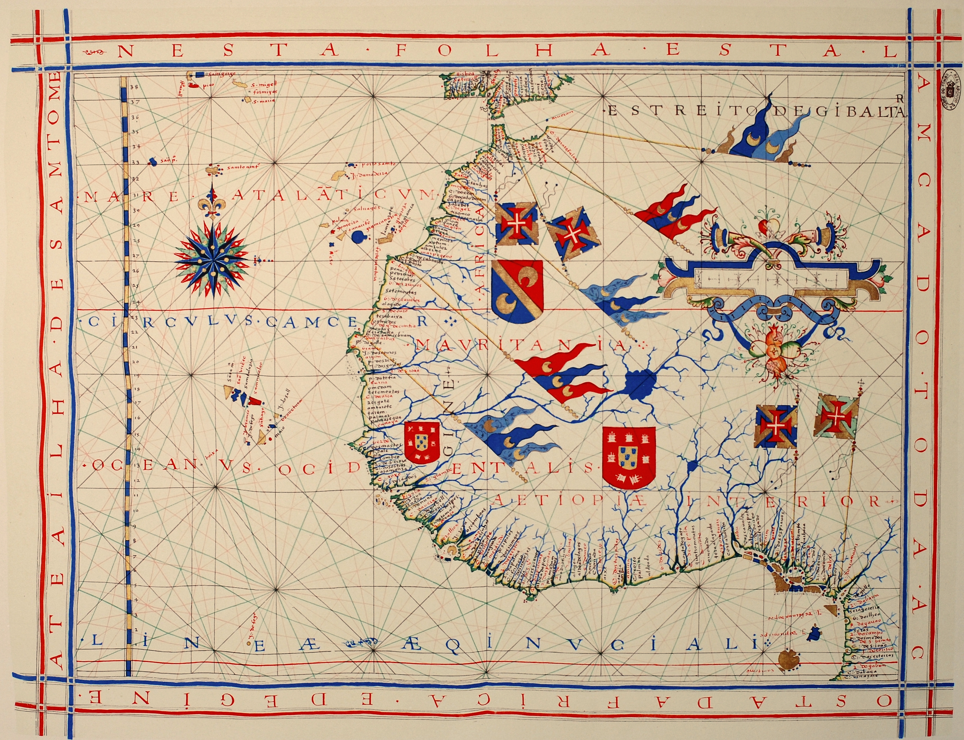
The real start of Cartography as an organized profession built around the arts and sciences related to chart and map making was the "School "of Henry the Navigator of Portugal. The Italians may have started earlier with a less centralized effort, and the English and Spanish ran parallel efforts with lots of government involvement but Henry's "School" (more like a cartographic intelligence center) really started not only navigation and cartography down the path of organized arts and sciences but is also usually cited as the start of formal organization of that entire body of knowledge we call "the nautical arts and sciences".
 Image of Henry the Navigator form the 1470 Panels of St. Vincent We have noticed that some of our most visited blog posts have been posts that contained Cartographic elements. The most noticeable is reprinted below. It was simply a lead in and hyperlink to a Washington post feature that allowed viewers to look at world maps with a variety of overlays of information including political and economic. In our Oceanography section some features that we considered "infotainment" also include strong cartographic features. Site visitors are still clicking in to our site simply looking for our link to the Washington Post's "40 Maps" feature though it has been months since we first posted it. That forced me to think about cartography and my own maritime career. As Coast Guardsman and Merchant Marine Officer I mostly was a "consumer" of navigation charts, using them to assist me in getting the various vessels I was in charge of from point A to Point B. The only marks I ever made on a chart were pencil corrections and updates from NOAA's Notices to Mariners.
But things changed when I entered an admiralty law firm as an investigator. I found my self sort of reversing my navigational skills in exercises best described as "forensic navigation", then found myself being asked to create chart or map like trial exhibits for the presentation of my forensic navigation findings. Later as a federal maritime analyst I often found myself doing the same thing for "illustrations" in reports of investigation or audit. In talking with paralegals in a variety of legal specialty areas I find that the production of chart or map like exhibits is quite common. It is hard to convey spatial information using only words. Graphics are needed and the most organized, standardized, and information dense form is the map or nautical chart. The skill set that produces these many and varied graphic presentations of spatial information is called Cartography and we think it is a gift of the maritime world to the world at large. We also have discovered that it is a skill set often needed by a variety of occupations that don't start out in the nautical arts and sciences like lawyers and paralegals, and illustrators. Often these folks literally have to learn the skills while actually working on their first exhibit illustrative project involving spatial data. Thanks to the interest of so many of our visitors in these types of blog posts we realize that we should have a cartography section. Such things don't happen over night. For the time being we would direct our visitors in search of cartographic information to click into our "NAVIGATION" page where we are immediately starting a Cartographic sub section.
LOOK TO OUR NAVIGATION PAGE FOR MORE CARTOGRAPHIC INFORMATION
FROM THE WASHINGTON POST: 40 MAPS THAT EXPLAIN A GREAT DEAL ABOUT THE WORLD IN A GLANCE ALONG WITH LINKS THAT EXPLAIN A GREAT DEAL MORE.
15 Amazing Maps That Explain Everything
http://luufy.com/site/post/994?m=1
At first glance what we are about to link you to doesn't seem very maritime in character. But we consider cartography very much a nautical professional endeavor. Henry the Navigator turned it into a science. It occupies a great deal of the effort of the NOAA Corps, a uniformed naval service we have introduced you to on occasion. All mariners work with navigation charts, a form of map. We had a great deal of fun with this site and we learned a few things. So here is a link, we recommend spending a little time with this site. It may painlessly change your world view. Click on the link below:
http://www.washingtonpost.com/blogs/worldviews/wp/2013/08/12/40-maps-that-explain-the-world/?wpisrc=nl_wv------------------------------------------------------------------------------------------------------------
AMAZON's CHARTS and MAPS SHELF
Google Earth Map Overlays and Other Navigation Related Links
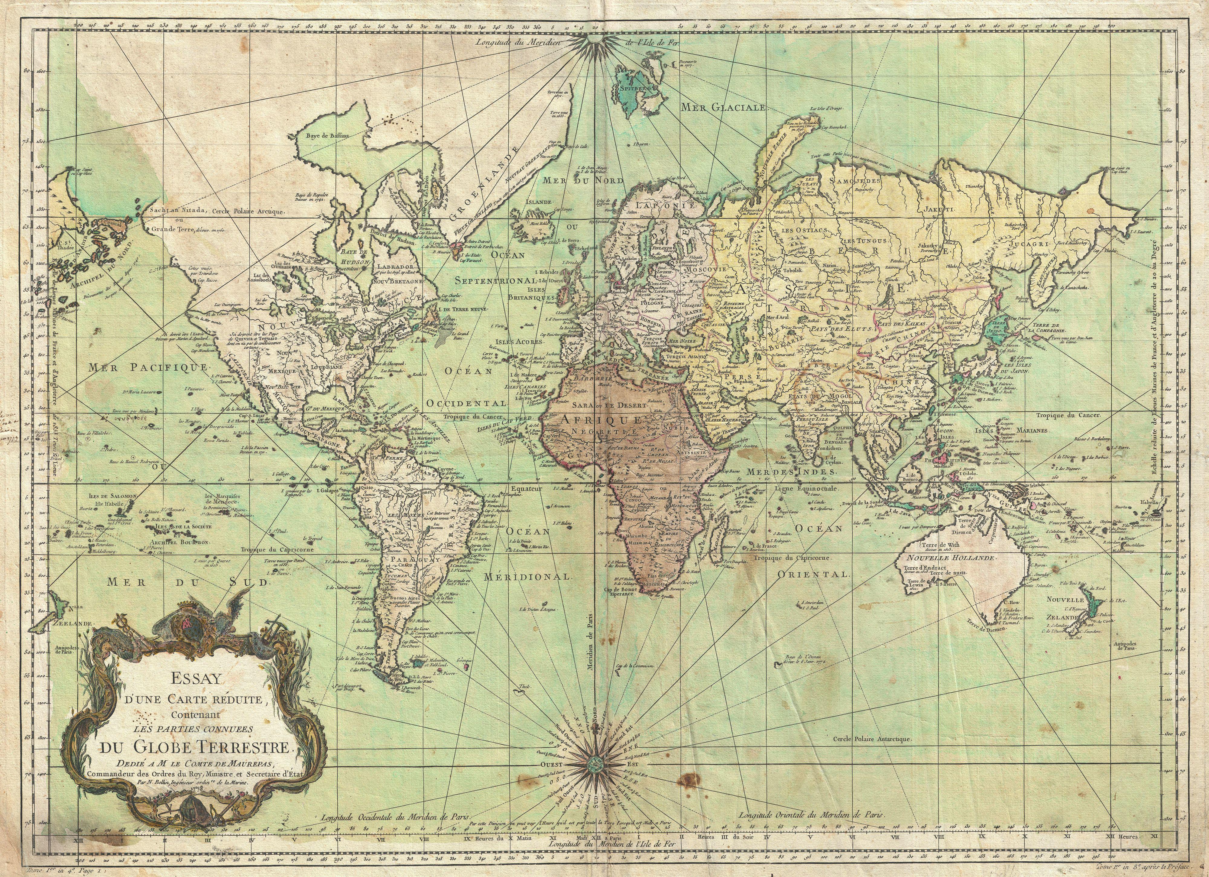 |
| The known world of 1778 |
and investigators are often involved in forensic navigation, determining when a
vessel was when an event litigated over occurred. Maritime and even non maritime
environmental litigation and project planning often require navigational and
cartographic skills and tools. We can't teach you to navigate in these pages but we
can link you to places that can. We can also link you to tools. Google Earth is a tool,
not a navigational course. But if you already know a bit about using and interpreting
maps and charts Google Earth can provide a lot of data without you having to leave
your computer desk. Goggle Earth virtually lets you "fly over the earth viewing satellite
imagery, and even street maps and in many places you can "swoop down for a ground
level view..http://www.google.com/earth/
Now tools (applications) are starting to appear that supplement and enhance what you
can do with Google Earth. Below are some descriptive passages from a Google Earth KML
network site that provides various types of over lays that you may apply with google Earth
maps.
"Here is a Google Earth KML network link that displays a big variety of tile based online
maps (road maps, terrain and contour maps, alternative satellite image sets, etc) in the
area you are currently viewing.This allows you to use your favorite map in 3D together
with other Google Earth layers to plan a trip, perform geospatial analyses, or simply have
better map sources where the data provided by Google is not as good:"
http://ge-map-overlays.appspot.com/
"Currently, 40 different map sources are supported. Most of these maps are based on
OpenStreetMap, but there also layers for Google Maps, Bing Maps and an extensive list of
regional map providers. You can switch between maps by clicking on them in the side bar:"
"Whenever you change the view in Google Earth, the image overlays are automatically
updated. Zoom levels for map tiles are calculated independently for different regions in the
Google Earth screen, based on distance to the virtual camera and on latitude. Consequently,
maps are updated very quickly and the number of map tiles loaded per update is more or
less constant, even if the view in Google Earth is tilted."
As we described in an earlier post the National Oceanic and Atmospheric Administration
nautical navigation charts are now on line at
the NOAA Charts on line but from a computer screen the scale, size, and resolution may
not be useful for much more than preliminary planning. All of NOAA's charts may be scannedinto a printer. But for real accuracy you'll want a full color very large printer like those used
for drafting projects. Its really not an issue. There are many NOAA Chart distributors around
with the equipment for down loading and printing charts in color, full size for very reasonable
prices. But for forensic work you should ask for a fresh print and not buy rolled stock off the
shelves. The electronic printing system insures that your chart contains accurate chart
information up to the day it was printed. If you use paper charts for navigation you will need
to make pencil updates before the start of any voyage planning session from on line NOAA data.
----------------------------------------------------------------------------------------------------------------------------
CARTOGRAPHIC LINKS:
Cartography, an encyclopedic treatment: http://en.wikipedia.org/wiki/Cartography
A professional Association: http://www.cartogis.org/
An International Association: http://icaci.org/
The History of Cartography Project: http://www.geography.wisc.edu/histcart/
Images of Cartography; maps, tools, related art, etc. Cartography Images Click on image,
larger image appears, click on "visit page" check photo credit if any, quite a few still have copy right
protection. If the image is in the public domain and you want to use it click the back arrow and
when you reach the enlarged page click on "view image",.click and hold and slide cursor over image
then click "copy" from the drop down menu.
HISTORICAL CARTOGRAPHIC:
Interactive map of British ship wrecks. Click on map & read details of wreck: http://www.english-heritage.org.uk/discover/maritime/map/
ATLAPEDIA: A web site that provides free read on line "white papers" on the nations of the earth with brief histories, demographics, descriptions of governments, economics, etc, about the equivalent of one comprehensive type written page per country, free but very large area low detailed maps of all nations both political and topographic features, and links to map and chart providers of all sorts
http://www.atlapedia.com/
Shop for World Maps on Google: https://www.google.com/webhp?source=search_app#q=WORLD+MAPS&start=10&tbm=shop
NAVIGATION AND CARTOGRAPHY BOOK SHELF
AMAZON's CHARTS and MAPS SHELF
BOOKS ABOUT CARTOGRAPHY:
NAVIGATION AND CARTOGRAPHY BOOK SHELF
Maphttp://www.vox.com/a/maps-explain-the-middle-east
 Map: CIA's WORLD FACT BOOK
We have in our NAVIGATION SECTION a subsection on CARTOGRAPHY where we like to collect links to sites that explain all sorts of information using traditional cartographic techniques. Properly prepared maps can present all sorts of information on subjects that go far beyond how to navigate from point A to Point B. Our single most popular post within the blog is a simple link to "THE WORLD EXPLAINED IN 40 MAPS a cartographic presentation by the Washington Post. Recently we came across a similar presentation by an organization called VOX and an author / editor named Max Fisher. Unlike the global content of ,THE WORLD EXPLAINED IN 40 MAPS this new link "40 Maps That Explain The Middle East" deals with the Middle East, the region depicted on the CIA WORLD FACT BOOK map illustrated above. We found this new site extremely informative and will be placing the link to it permanently in our NAVIGATION AND CARTOGRAPHY SECTION . We try to alert our general readers when we find something like this of interest and long term utility. Unfortunately we have found that our daily posts, tweets, Facebook postings, and G mail posts are a very big and not well organized collection and our key word search engine seems to be more of a title search engine. So the really utilitarian stuff we try to find a permanent home for in our subject matter reference pages. These are listed to your right at the home page and each listing is a hot link to the special interest page . Just click on the name of the special interest page and you're there. Each Special Interest Page contains books, book reviews and recommendations, videos, links to free videos, links to specialized sites on the particular subjects aligned with the page title, and some cases descriptions and contact information for relevant schools and training institutions.
We highly recommend "40 Maps That Explain The Middle East" as a quick visual reference guide and background source for this most complex and constantly news making region.
ON LINE MAPS AND CHARTS STORE
ping by David Greenhood. ISBN # : ISBN-10: 0226306976 |
ISBN-13: 978-0226306971 . A comprehensive Introductory text. AAB
recommended for HS through adult readers
VIDEOS
20 Free Videos on Cartography: http://www.youtube.com/watch?v=X4wgFSHZXBg&list=PLzUhMQ_VeoQXXe8F-mvPQIGpr1IKDJTLB
LOOKING FOR INEXPENSIVE DOWNLOADABLE WORLD
MAPS ? Try:

The History of Cartography Project: http://www.geography.wisc.edu/histcart/
Images of Cartography; maps, tools, related art, etc. Cartography Images Click on image,
larger image appears, click on "visit page" check photo credit if any, quite a few still have copy right
protection. If the image is in the public domain and you want to use it click the back arrow and
when you reach the enlarged page click on "view image",.click and hold and slide cursor over image
then click "copy" from the drop down menu.
HISTORICAL CARTOGRAPHIC:
Interactive map of British ship wrecks. Click on map & read details of wreck: http://www.english-heritage.org.uk/discover/maritime/map/
LINKS SUGGESTED BY CYNTHIA LANIUS , Publisher of MATHEMATICS OF CARTOGRAPHYThe Mining Company - WOWInstitute of Mathematical GeographyUS Geological Survey...3 hours later (or 3 days) National Geographic Society Mapmaker, Make me a Map from U of TN The Great Globe Gallery Awesome Graphics Projections and Coordinate Systems U of Toronto How Far Is It? Yahoo maps Xerox PARC Map Viewer MapArt by CartesiaPtolemy Armadillo's Texas MapsA Big List, of course LOTS of links from Utrecht University More links Oddens's Bookmarks Dictionary of terms |
ATLAPEDIA: A web site that provides free read on line "white papers" on the nations of the earth with brief histories, demographics, descriptions of governments, economics, etc, about the equivalent of one comprehensive type written page per country, free but very large area low detailed maps of all nations both political and topographic features, and links to map and chart providers of all sorts
http://www.atlapedia.com/
Shop for World Maps on Google: https://www.google.com/webhp?source=search_app#q=WORLD+MAPS&start=10&tbm=shop
NAVIGATION AND CARTOGRAPHY BOOK SHELFAMAZON's CHARTS and MAPS SHELF
BOOKS ABOUT CARTOGRAPHY:
NAVIGATION AND CARTOGRAPHY BOOK SHELF
Maphttp://www.vox.com/a/maps-explain-the-middle-east
AS NAVIGATORS WE HAVE AN AFFINITY FOR CHARTS, MAPS, AND CARTOGRAPHY AS A WAY OF PRESENTING INFORMATION
Map: CIA's WORLD FACT BOOKWe have in our NAVIGATION SECTION a subsection on CARTOGRAPHY where we like to collect links to sites that explain all sorts of information using traditional cartographic techniques. Properly prepared maps can present all sorts of information on subjects that go far beyond how to navigate from point A to Point B. Our single most popular post within the blog is a simple link to "THE WORLD EXPLAINED IN 40 MAPS a cartographic presentation by the Washington Post. Recently we came across a similar presentation by an organization called VOX and an author / editor named Max Fisher. Unlike the global content of ,THE WORLD EXPLAINED IN 40 MAPS this new link "40 Maps That Explain The Middle East" deals with the Middle East, the region depicted on the CIA WORLD FACT BOOK map illustrated above. We found this new site extremely informative and will be placing the link to it permanently in our NAVIGATION AND CARTOGRAPHY SECTION . We try to alert our general readers when we find something like this of interest and long term utility. Unfortunately we have found that our daily posts, tweets, Facebook postings, and G mail posts are a very big and not well organized collection and our key word search engine seems to be more of a title search engine. So the really utilitarian stuff we try to find a permanent home for in our subject matter reference pages. These are listed to your right at the home page and each listing is a hot link to the special interest page . Just click on the name of the special interest page and you're there. Each Special Interest Page contains books, book reviews and recommendations, videos, links to free videos, links to specialized sites on the particular subjects aligned with the page title, and some cases descriptions and contact information for relevant schools and training institutions.
We highly recommend "40 Maps That Explain The Middle East" as a quick visual reference guide and background source for this most complex and constantly news making region.
ON LINE MAPS AND CHARTS STORE
ping by David Greenhood. ISBN # : ISBN-10: 0226306976 |ISBN-13: 978-0226306971 . A comprehensive Introductory text. AAB
recommended for HS through adult readers
VIDEOS
20 Free Videos on Cartography: http://www.youtube.com/watch?v=X4wgFSHZXBg&list=PLzUhMQ_VeoQXXe8F-mvPQIGpr1IKDJTLB
LOOKING FOR INEXPENSIVE DOWNLOADABLE WORLD
MAPS ? Try:
Marina Shemesh
NEED LARGE WALL MAPS AND SIMILAR PHYSICAL MAP REPRODUCTIONS FOR CLASS
ROOMS, COURT EXHIBITS, ETC.? Try: WALL MAPS
-----------------------------------------------------------------------
"THE MAP OF FREEDOM" http://www.democracyweb.org/new-map/
"About Freedom in the World
THE CIA WORLD FACT BOOK: This is a most comprehensive geographic reference with background material on about 267 world areas with lots of maps and illustrations all in the public domain and available for yoru use in reports and even publications, https://www.cia.gov/library/publications/the-world-factbook/docs/refmaps.html
NAVIGATION AND CARTOGRAPHY BOOK SHELF
JUST FOR FUN: MAPS THAT WILL BLOW YOUR MIND. DEMOGRAPHICS, ECONOMICS,
POLITICS, AND MORE: http://funnzoo.com/site/post/1015
We have noted the popularity of our link to "40 Maps That Will Change Your View of The World", A Washington Post on line post. Indeed visitor reaction to this type of cartographic presentation of information has been so strong that we are building a cartographic subsection within our NAVIGATION section. We recently came across a most interesting cartographic representation of human freedom on a global scale that we thought you might like to see. We'll be adding this as a permanent link in our cartography section. Below is a quote from the site describing how they define "freedom" for the purpose of the map presentation:
 |
| PD-old-100 Nova Totius Terrarum Orbis Tabula (1684) by A. J. Bormeester - See more at: http://publicdomainreview.org/2011/09/22/maps-from-geographicus/#sthash.COOjxAZY.dpuf |
"About Freedom in the World
What the Survey measures
The Freedom in the World survey, which has been published since 1972, is an annual evaluation of the state of freedom in every country in the world. The survey divides freedom into two broad categories: political rights and civil liberties. Political rights allow people to join political parties and organizations, compete for public office, vote freely for distinct alternative candidates in legitimate elections, and elect representatives who have a real impact on public policies and are accountable to voters. Civil liberties allow for the freedoms of expression and belief, associational and organizational rights, rule of law, and personal autonomy, including economic freedom, without interference from the state.
The standards that Freedom in the World uses to measure freedom are based largely on the United Nations' Universal Declaration of Human Rights, a document that represents the first global expression of rights to which everyone is entitled. These standards are applied to all countries, regardless of their geographical location, ethnic or religious composition, culture, or level of economic development.
Freedom can be affected by both the government and nongovernmental forces, including armed rebel groups, organized crime, and powerful business interests. Therefore, Freedom in the World measures the real-world rights enjoyed by individuals, rather than just the attitude or performance of governments.
Finally, Freedom in the World considers both legal guarantees of rights and the real-world expression of these rights — or practices — when measuring freedom. However, since repressive governments often adopt laws that protect political rights and civil liberties but fail to fully implement them, Freedom in the World places greater importance on actual practices than on laws when measuring freedom........"
GO TO: THE MAP OF FREEDOM
-----------------------------------------------------------------------------------------------------------------------------------------------
NAVIGATION AND CARTOGRAPHY BOOK SHELF JUST FOR FUN: MAPS THAT WILL BLOW YOUR MIND. DEMOGRAPHICS, ECONOMICS,
POLITICS, AND MORE: http://funnzoo.com/site/post/1015
Interesting articles & Lot more things I wish to know and discuss. Turkey allows Barbados citizens tourist, transit, or business visa. It takes only a few minutes to fill out your turkey visa for Barbados citizens application form online. Turkey visas for Barbados citizens can apply from anywhere in the world with an Internet connection.
ReplyDeleteExcellet post.. Thank you.. After the applying for application and uploading documents for Azerbaijan visa, you have to make payment for Azerbaijan visa fee online with the payment card.
ReplyDeleteFantastic article. Thank you Wish to know the about all types of visas to Kenyya then check out the Kenya visa invitation letter where, you will get the complete information about the Kenya visa and its types.
ReplyDeleteI am enjoying every bit of it. It is a good site, as well as the stock is well-chosen. Thank you.emergency visa to India, You can fill your emergency Indian visa application form and get your visa within 1 to 3 business days.
ReplyDeleteCan Africans apply for the East Africa tourist visa for Kenya? Yes, you need a visa if you are an African traveler, and you can obtain your visa to travel to Kenya.
ReplyDeleteHello there! Your posts are a joy to read. Just wanted to drop a quick comment to show my support. Second Passport Guide, Expanding Travel Options Learn about the advantages and process of acquiring a second passport, empowering you to explore the world with greater flexibility and opportunities.
ReplyDelete