 Mississippi's Horn Island Photo Credit National Park Service |
| Typical Storm Water Run Off Pipe Mississippi Gulf Coast Photo Credit SUN HERALD |
One of the most scenic drives in America is US highway 90 along the Mississippi Gulf Coast. As you proceed along the highway in either direction you will see beautiful uncrowded beaches and the waters of Mississippi Sound on one side and interesting architecture on the other. Unlike Malibu and many other beach resorts in the United States the public has free access to the entire roughly 23 miles of sand except for a few marked areas reserved for the nesting and resting of the "Least Terns," beautiful tiny white shore birds once on the brink of extinction. Pelicans can be seen in abundance. While the beach is man made as a hurricane protection feature it is taking on a more natural look as barrier island plants,with the help of deliberate but natural looking plantings, colonize some of the low man made duns. All along the road on the land side are beautiful live oaks, palmetto palms, Carolina or Texas Sable Palms, Canary Island and Royal Palms. Though the Mississippi Gulf Coast is actually semi tropical, the look of the place is that of a tropical; beach paradise. But the view from the road can be deceiving,

Gulf Islands National Seashore Near Biloxi photo credit National Park Service
BUT THERE ARE SNAKES IN PARADISE :
This summer (2019) nearly all of the mainland beaches of Mississippi were closed for swimming and people were cautioned not to come into contact with the water. The problem is sometimes called a "red tide" though this one and others were often green. It is a natural phenomena, though it can be exacerbated by human activities. It is most often a phenomena of near shore and especially semi sheltered waters in brackish estuaries.The closure of the beaches put a dampener on the tourist industry. While the gambling casinos remained open and their parking lots indicated a still lively trade the beach dependent business such as beach front restaurants and beach related shops suffered. The beach equipment (lounge chairs, jet skis, shade umbrellas etc.) suffered the most direct impact once the warnings went up to stay away from the waters, most closed for the season, some probably permanently. The primary cause of the algae invasion is thought to be the massive influx of fresh water into Mississippi Sound from the flood control efforts of the U.S. Army Corps of Engineers on the near by Mississippi River. However, even if Mississippi is able to resolve its problem with the Corps flood protective efforts for near by New Orleans, periodic micro organism pollution along the Mississippi mainland beaches sufficient to cause beach closures still occur due to local sources of pollution, particularly street run off. the best known culprit? Storm water run off pipes that run under the beach depositing street run off right into the water almost on the beach.
The unusual amount of fresh water that entered Mississippi Sound from Louisiana's flood water diversions reduced salinity in the Sound and created water conditions conducive to algae growth over a wide region near the mainland beaches. The Gulf Coast of Mississippi, however has a very rainy warm semi tropical climate. The typical summer weather pattern includes afternoon thunder showers that do not engulf large areas but are a bit hit or miss with some areas adjacent to a down pour being dry for an entire day. The thunder storms are sufficient to cause a major street water run off event and resulting high pollution levels around some times less than a half dozen storm water run off pipes. Some of these events are sufficient to cause a beach closure along a particular stretch of beach. The area is also subject to tropical type storms once or more every summer. These spread rain over most of , or the entire area resulting in wide spread beach pollution from storm water run off. A similar phenomena occurs in the winter months when the occasional frontal system system comes down from the north and the entire area is enveloped in rain for a day or more.
Street drainage is much more harmful than previously thought when the present drainage system was built. It contains oils from the streets themselves, and run off from lawns such as high nitrogen content fertilizers, insecticides, dog waste, bird droppings, and occasionally raw sewerage. Rerouting all of the storm drainage would be prohibitively costly and really no matter what you do with the storm water run off on the Mississippi Gulf Coast it has to end up eventually in the bays and Mississippi Sound. But one project thought of as "cosmetic" because it doesn't provide for treatment of the storm water run off is setting the stage for improvement. The "wave form" storm water out falls simply eliminate some of the eye sore nature nature of the existing out fall pipes. These attractive forms can also accommodate the storm water load from multiple pipes that can be connected under the beach and the combined discharge can enter the Mississippi sound through the larger outfall of the "Wave Form"drain. This development reduces the number of points where pollution enters the beach water and while it has no inherent pollution abatement features the outfall lends itself to discharge into a settlement marsh created by a different program at a later time. It is estimated that 250 of these "wave form" drains could replace 300 of today's pipe outfalls. The state is already moving ahead with this program and the first three wave form drains or outfalls will be built this year.
The complete process will cost tens of millions of dollars and probably take decades. We don't think the beach can wait that long. The benefits of the Wave Forms may be obtainable much more quickly by individual municipalities or counties going in and connecting two or more outfall pipes with ordinary building material under the beach. The old, no longer connected outfall pipes could be removed. This is a less expensive way to both attack the "eye sores" and reduce the number of point sources of pollution. The single outfall pipe would be two or three times the diameter of the typical outfall but would still lend itself to added on settlement marsh type pollution abatement at its discharge end. Take a look at the wave form design via this link to a SunHerald video
THE PAST HOLDS THE KEY TO THE FUTURE:
There is an incredibly scenic beach road also known as U.S. Highway 90 or the "Old Spanish Trail " that parallels miles of sand beach. That sand beach isn't what was there originally. The original landscape was more marshy and capable of absorbing and processing far more pollutants than today's sterile beaches another product of flood protection courtesy of mostly the Army Corps of Engineers. Indeed since sunlight (available in abundance despite the high level of rainfall) has a disinfectant effect on many micro organisms including algae just slowing the flow of pollutants along the beach line would greatly reduce pollution . What is needed immediately is an inexpensive pollution mitigation system, that can be built in one or two seasons for the entire length of the beach. Given the expense of the wave form story drains already described and the high cost of the higher tech solutions you are about to read about, it is clear that what is needed fast in very inexpensive pollution mitigation system. We aren't here in proposing a storm water runoff pollution elimination system, but a mitigation system that the Coast communities can afford and produce quickly. Compare our proposal to the costs of the systems that recently won a design competition and the resulting time line for completion. The Mississippi Gulf Coast can't wait decades to seriously mitigate the present situation.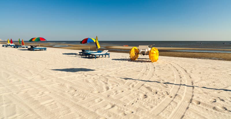
-----------------------------------------------------------------------------------------------------------------
INTERIM NOTES
Follow On for Helios Ruehls , Inc. Report No. 1
We apologize for the formatting errors we are working on this but all copy did post and we urge everyone to read these posts as they appear, We'll gt those formatting Errors fixed |
| Typical Storm Water Run Off Pipe Mississippi Gulf Coast Photo Credit SUN HERALD |
-----
Interim Notes Report No. 2 /post No.1WHAT ABOUT THE LOUISIANA FLOOD PROTECTION PROJECTS?
BULWARK AGAINST THE RED TIDE
| Typical Storm Water Run Off Pipe Mississippi Gulf Coast Photo Credit SUN HERALD |
I had intended this to be a more detailed report of the permit
processing process. However after a very recent trip to the
Mississippi Gulf Coast I found that the most often asked question or
objection to our proposed system is the fact that the
Army Corps of Engineersand Louisiana State Authorities plan
massive flood water diversion projects in the New Orleans area
with a great potential for causing serious fresh water intrusion into
Mississippi Gulf Coast especially Mississippi Sound. Among those
who understand the difference between a mostly salt water estuary
and a mostly fresh water estuary this seems to be an unmitigated
disaster . Much of the Mississippi Gulf Coast economy depends on
remaining a mostly salt water estuary.
In our view the Louisiana projects require a quite different
approach than the storm water run off pipe pollution issue.
Even if the estuary would change to fresh water the mini marshes
of our storm water run off system would be necessary
to mitigate beach front pollution. However some of the vegetation
might have to be replaced as the design is salt water tolerant.However
many native plants of the estuary have a quite large range of salt to
fresh water that they can thrive in. The beach
storm run off pipes number about 300 and run the length of
the beach about 23 miles. Collectively they represent a macro problem
of pollution mitigation.Individually each pipe could be mitigated by
the labor of a garden club or similar organization. The cross beach
storm water run off problem is a Macro problem
that lends it self to micro solutions.
By contrast the Corps of Engineers projects in Louisiana present
a mega problem to the Mississippi Sound environment and human
communities. The mega problem that emerges from the mega projects
can only be addressed by mega solutions mostly to be proposed and
demanded by Mississippi State political office holders. The state must
stand up to the Corps and Louisiana and demand that the fresh water intrusion
issue be dealt with. What is needed to mitigate fresh water intrusion is not
on the order of a true mega project.The Corps can and should do the
necessary to mitigate fresh water intrusion into Mississippi Sound from
new flood protection and marsh restoration projects in Louisiana.
Why The Corps Can Do It:
Where does the salt water go when massive amounts of fresh water
intrude into an estuary? It goes down deeper into the water column.
The water becomes layered with the fresh water on top and the
salt water lower. It takes a long time for it to mix.
But an estuary like Mississippi Sound with its many openings to
the sea never becomes truly a fresh water estuary. When the floods
subside salinity increases . Unfortunately during the period of massive
fresh water intrusion salt water species flee. During this last fresh water
event every thing from pelicans to bait fish disappeared and
years of damage was done to oyster beds. The Corps may argue that
the environment recovers over time, but will the salt water based economy
recover enough to withstand the next fresh water invasion? Think of the beach
closures and the closures of the beach rental equipment small businesses most of
which lost an entire season to the fresh water intrusion and resulting algae blooms
and some of whom will never recover. So what might the corps do to mitigate these
Louisiana projects negative effects on Mississippi sound?
First there is a direct connection between the erosion of the St. Bernard Parish
marshes and the fresh water intrusions into Mississippi Sound. Just pouring
fresh water into the marsh will not grow marsh substantial enough in time enough to
stem the danger. Mississippi must insist that in Louisiana the Corps manage the
"Mud Budget" for maximum marsh building. Water is not enough for marsh
building the marshes need river sediment as well. The Corps should also be
held responsible for some "mechanical marsh building" as in Christmas tree
soil catchers and planted emergent vegetation. Much of the flood waters if
the Corps projects are built will flow into the remains of the
Saint Bernard parish marshes with a straight shot at Mississippi Sound.
The corps must build marshes almost as fast as they build flood walls and
pumping stations.
There was a period in geologic time when the St. Bernard Parish marshes were
in fact the delta of the Mississippi. Then the river moved north ward and
flowed through what is now Lake Pontchartrain. A remnant of the old river channel
can still be detected at Pass Manchac between Lake Pontchartrain and its sister fresh
water lake, Lake Maurepas. Old pieces of the river channel are also detectable at the
Pass Rigolets and Pass Chef Menteur and it is through these passes that much of
the recent flood water run off from Lake Pontchartrain travels to reach Mississippi
Sound. The river eventually build up a natural levee that forms most of Orleans
Parish, then crossed over it and started forming the channels that would eventually
lead to the formation of the present bird foot delta.. Every few years the river would
flow over the natural levee and send major fresh waters into Lake Pontchartrain.
Then man came to the region and eventually the high levees were built up
containing river between its banks most years. Eventually the Corps of Engineers
found that they had to allow plenty of run off into Lake Pontchartrain various marshes
and the Atchafalaya River to prevent catastrophic flooding at New Orleans.
The resulting relief channels are generally called "Spill Ways". It was
a record long opening of the Bonnet Carré Spillway into Lake Pontchartrain over the
Spring and summer that caused the problems along the Mississippi beaches this in 2019.
Because such opening create layered fresh water intrusions and the fresh water goes
to the top effective barriers can be constructed or deployed to slow the intrusion.;
Imagine what might have happened if the Corps determined the depth of the fresh water
column and deployed floating barriers between the Pontchartrain passes and "Lake" Borne?
Had they done so the fresh water intrusion into Mississippi Sound would have been less
severe. Such booms should consist of a positively buoyant upper level with a negatively
buoyant "skirt below. Such deployable barriers across the existing passes through the
waters passed this year would not be expensive by Corps standards. There would be some necessary research to assure optimum performance, The unanswered question is how
deep do the negatively buoyant "skirts" have to run at the passes in order to
effectively impede a critical mass of fresh water? The good news is that the
passes are not wide. so such barriers would not have to be very expensive in
terms of length. The other good news is that such barriers wouldn't block drainage,
simply allow more of the drainage to consist of saltier water.
So the the maintenance of some deployable fresh water intrusion booms at the passes and their deployment during openings of the Bonnet Carré Spillway could go a long way towards mitigation
of the periodic fresh water intrusion problem. BUT the new Corps/ State of Louisiana plans are
to create new spill ways some of which may be pointed directly at Mississippi sound
across an inadequate marsh. It is inevitable that Mississippi sound will be affected by such projects in Louisiana. It is inescapable that Mississippi officials must pay attention and
demand a seat at the table when the Corps plans mega projects in Louisiana east of the Mississippi. It is also inescapable that the voters of the Mississippi Gulf Coast need to
hold their public officials responsible for doing that. The only citizen actions that can
affect the fresh water intrusion from Louisiana are political. Citizens may write their
congressional representatives, Louisiana's congressional delegation, and the Corps of Engineers;
but the most effective action is to hold the Mississippi politicians feet to the fire for a place at the table when the Corps plans mega flood control or navigation channel maintenance on or east of the Mississippi.
A Few Points To Keep In Mind
The present bird foot delta is your friend. The present delta unlike previous deltas in geologic
time channels the river water south of Mississippi Sound and deposits it in the deep Gulf where
the fresh water intermixes with the salt more rapidly. As long as the river isn't threatening to over top its banks the bird foot delta keeps the harmful levels of fresh water out of Mississippi, MONITOR CAREFULLY ANY ATTEMPTS BY THE CORPS TO ABANDON THE SOUTHWEST PASS NAVIGATION CHANNEL.
A new entrance to the Mississippi north and east of SW Pass could put more fresh water in
Mississippi Sound year round. There are groups in Louisiana advocating for such changes now.
If it becomes inevitable that the shipping channel must be shifted north and east of the present bird
foot delta, Mississippi should demand that the Corps establish with dredge spoils a string of marshy barrier islands from the Chandelier Islands to near Cat Island to slow, and filter the constant fresh
water discharge aimed at Mississippi Sound. Dredge spoil barrier islands could also substitute for floating fresh water intrusion barriers at the Lake Pontchartrain passes .
Insist that the corps manage the mud budget in Louisiana. The St. Bernard marshes have deteriorated from lush marsh to a collection of lots of marshy islands, Some forms of fisheries
have benefited from this condition and developed a constituency. These commercial fishermen
should be compensated for the temporary or permanent damage to their livelihood but the
marsh must receive replenishing mud not just fresh water all of which unslowed by marsh will
run right into Mississippi Sound.
The new equivalents of new spill ways coming to Louisiana present a major problem
that will not yield to garden club members wielding shovels as the storm water run
off pipes will. This is a mega problem requiring political as well as engineering solutions .
OUR BOTTOM LINE: We have volunteered to help engineer a mitigation feature for the
Storm Water run off pipe induced pollution along the beach. We can't really do much
about the big and future fresh water intrusion from major Corps projects. See
your Mississippi State office holders. The possibility of another big fresh water intrusion
event from Louisiana waters should in no way affect the desire to clean up the storm
water run off problems along the beach. As we said in our first post we are proposing
an incremental mitigation system for one problem on the Mississippi Beaches, storm water
run off.
---------------------------------------------------------------------------------------------------------------------------------
BULWARK AGAINST THE RED TIDE
The Details of the Permitting Process
The Details of the Permitting Process
| Typical Storm Water Run Off Pipe Mississippi Gulf Coast Photo Credit SUN HERALD |
We are attempting to negotiate a simpler , faster permit process. As things change we will
post relevant changes here as "Report No.2 post NO._________". Eventually there will be
a printed and bound version of this handbook but the electronic version which you are
reading under construction will be up for quite some time after the print version is
distributed,
SO WHERE DOES THE PERMIT PROCESS BEGIN?
(1) We think the smart route is to start with the Mississippi Secretary of State. The
waters just a few yards out from the beach belong to the state and the Secretary
of State is their "custodian" after a fashion. By obtaining a letter of "no objection"
or better yet an endorsement from the Secretary of State FIRST any group wanting to
build settlement marches has their way smoothed and avoids problems on the eve of
construction:
Write to:
OFFICE OF THE MISSISSIPPI SECRETARY OF STATE P.O. BOX 136,
JACKSON, MS 39205-0136
JACKSON, MS 39205-0136
ATTN: (Name of current Secretary at the time you actually write
For follow up:
Phone: (601) 359-1633
Next: Contact The U.S. Army Corps of Engineers Mobile District at phone number
251 690 2505 or main switch board at 251 690 3208. Our preliminary contacts with the
Corps indicate that with only a few exceptions (near regulated marshes and shipping
channels) this activity is covered by a "National General Permit"None the less because
there are a few exceptions you should talk with some one there in charge of permits. Then
follow up with a letter requesting a letter of confirmation that your activity is covered by
the "General Permit". As long as your project is not particularly near the Gulf Port
Channel or at the extreme east or west ends of the beach where the beach is near regulated
wet lands we doubt that you will have anything but a pleasant experience dealing with the
Corps. It my seem like a hassle to ask for letters of no objection from agencies with
probably no permit requirements, but it is worth the effort. All agencies listed here have
some sort of statutory authority over the areas where you will be working. One inspector
who happens along your activity could halt construction for critical days while checking
your permitted status. In making signs to put up during construction list not only all
permits by agency with permit numbers but also letters of no objection or endorsement,
or notice of coverage buy general permit by agency and date of letter.
Then: Contact the Mississippi Department of Marine Resources: at phone 225 523 1109.
This agency has state wide jurisdiction over such projects. In our preliminary talks with
them they were very helpful. Preliminary contact indicated that they viewed the project
as a "Wildlife Enhancement" and thought no permit would be needed. If that continues
to be the case you will want a letter of no objection. If a permit is required the
application forms are simple and the fees typically around $10.
Now things change with each municipality and /or county that abuts the section of
beach you are planning to work. Some have regulations and even enforcement agencies
for the beach. None claim jurisdiction seaward of the low water line. Again if there is
no claim of jurisdiction and permits are not required we advise that you write the mayor
or other chief official requesting a letter of no objection. In the case of Long Beach there
is literally a "Sand Beach Department "
Long Beach, Mississippi
Sand Beach Authority
Phone: 226 896 0055
Sand Beach advised us that they do not exercise jurisdiction seaward of the low water
mark where most of your work will be . However you will have to cross the beach to get
the job done. Such construction would be easier if you were allowed to go on the beach
with a light pick up truck. Sand Beach Authority can help you in Long Beach. Elsewhere
along the beach you should exchange some phone calls with the local police and state police
so that their watch officers know where you are and what you are doing.Keep any
return mail and reference it on your project's signage.
And Finally: You will have to have a formal permit from the US Fish and Wild Life Service
This will be the most comprehensive permit that you will need. It will be necessary to provide
copies of all letters of no objection or endorsement and all permits along with drawings
of the project, dimensions, of the project , precise location (include map) , and a virtual
environmental impact statement. Be sure to include the names of all plants used
( best to include Latin names) and it is best to use only native plants. This permit
comes with fees generally but under some circumstances these may be reduced or waived
for certain groups or types of projects . A key word to use in all written correspondence and
in some of your phone work is "Wildlife Enhancement Project" . We know that the
primary purpose of the settlement marsh is pollution reduction. That in and of itself
is a "wild life enhancement" but don't expect that to be sufficient. You will have to explain how
the marsh itself once established works to improve wild life. One example is the nursery effect
of even a small marsh. That can be mentioned generally but be prepared to account for the
effects on typical salt marsh creatures ( by common name and Latin name) , This is the permit
that you may need help with from a local botany or marine biology instructor. The service
provides some fill in the blank forms but you have to create the required attachments like
project drawings , maps, environmental impact information. Be sure to negotiate the fees in
advance and send a check in with your application for permit:
 | |
|
HERE IS WHAT THE USFW HAD POSTED ON THEIR WEBSITE ABOUT
PERMITS IN IN GENERAL AS OF OCTOBER OF 2019
PERMITS IN IN GENERAL AS OF OCTOBER OF 2019
"The U.S. Fish & Wildlife Service issues permits under various wildlife laws and treaties at different offices at the national, regional, and/or wildlife port levels. (We do not issue hunting and fishing licenses. Instead, those are issued by State wildlife agencies.)
Permits enable the public to engage in legitimate wildlife-related activities that would otherwise be prohibited by law. Service permit programs ensure that such activities are carried out in a manner that safeguards wildlife. Additionally, some permits promote conservation efforts by authorizing scientific research, generating data, or allowing wildlife management and rehabilitation activities to go forward.
Permits are handled by permitting programs in International Affairs (Management Authority), Endangered Species, Law Enforcement, and Migratory Birds. (Visit the National Wildlife Refuge web site for Special Use Permits.) For more detailed infromation, go to How to Obtain a Permit, FAQs/Facts, or Application Forms. 0
Endangered Species regional offices administer native endangered and threatened species permits under the Endangered Species Act (except permits for import and export). Permits are issued to qualified applicants for the following types of activities: enhancement of survival associated with Safe Harbor Agreements and Candidate Conservation Agreements with Assurances, incidental take associated with Habitat Conservation Plans, recovery, and interstate commerce. Permits for import and export are issued by International Affairs (Division of Management Authority) below.
International Affairs(Management Authority) is responsible for administering CITES for the United States. We primarily issue permits to import and export species that are protected by CITES and by various other wildlife conservation laws. Some examples of other activities we permit are: take of certain marine mammals; take and interstate and foreign commerce of non-native species protected by the Endangered Species Act, including a captive-bred wildlife registration; cooperative breeding programs for live exotic birds covered by the Wild Bird Conservation Act; and import and transport of injurious wildlife.
Law Enforcement administers permits at regional offices and certain port locations. A permit or license may be issued to qualified applicants for the following activities: to engage in business as a wildlife importer or exporter; import or export wildlife at other than an designated or authorized border or special port, and export and re-export certain CITES wildlife.
Migratory Bird regional offices administer permits for qualified applicants for the followingtypes of activities: falconry, raptor propagation, scientific collecting, rehabilitation, conservation education, migratory game bird propagation, salvage, depredation control, taxidermy, and waterfowl sale and disposal. These offices also administer permit activities involving bald and golden eagles, as authorized by the Bald and Golden Eagle Protection Act.
Broadband Connectivity in rural America. Information about regulations is available here; information about right-of-way permits is here."
|
Here is the service's "How To " guidance on permits:
How to Obtain a Permit
Step 1. Does my activity involve animals or plants?
• For activities involving animals continue to Step 2.
• For any activities involving plants, continue to Step 3.
Step 2. Does my activity with animals occur only within the United States or does it involve movement across international borders?
• If your activity with animals occurs completely within the United States, continue to Step 3. • If your activity with animals involves import, export, international travel, international mail, purchase from or sale to a foreign country, or other movement across international borders, click on International Wildlife and then return to Step 3 on this page.
Step 3. Is the species protected?
• Check all the appropriate lists to determine if the animal or plant is protected. The different lists do not include all common names for every listed species. In addition, in some lists, the scientific names of some species are not individually shown on the list or in the database. A number of the listings are not at the species level, some are by larger groups of related animals or plants. • If you do not find the species name on one of the lists, confirm that the species is not listed by contacting a permit office (see Step 6). • If a species is protected by more than one law or treaty, the permitting requirements of all laws apply. • In most instances, you may submit a single application and obtain one permit when a species is protected by more than one law or treaty.
Step 4. Is the activity regulated or allowed under a permit?
The following table lists the basic activities that may be authorized by a permit under different laws and treaties, and their implementing regulations. The regulations define the types of activities that require permits, and provide specific information that may help you decide if your proposed activity needs a permit. Visit the Laws/Treaties/Regulations page to access text of the laws, treaties, and regulations. If you cannot find your activity in the table below, review keywords under the Application Forms page.
.
Step 5. How do I obtain and complete a permit application?
• Select the application form for the law or treaty and activity you want to conduct.
• Review the regulations that apply to the type of permit you need. • Complete the form following the instructions. • Attach the application fee, if applicable. • Check that your application is completely filled out and signed. This will help avoid delays. • Some applications may require that you have a State or foreign permit before you can obtain a Federal permit. You may need to contact your State wildlife or plant conservation agency and/or the CITES Management Authority of the foreign importing or exporting country to determine any additional requirements. • If you are applying for a protected species permit(s) and also for a port exception permit, submit only page 2 of the port exception permit along with your protected species application to the appropriate protected species permit office. You will only need to submit the application fee for the protected species permit. • Contact the issuing permit office (see the top of the application form) if you have questions that are not answered in the FAQs/Facts section of this website.
Step 6. Where do I send my application?
• The address at the top of the application form indicates where you should submit the form.
• The U.S. Fish and Wildlife Service has four programs that issue permits. Each program handles a different category of permits, but some types of permits may be issued by more than one program.
Step 7. When will I receive my permit?
• You should allow at least 60 days for review of most permit applications.
• However, you should allow at least 90 days for review of marine mammal or endangered species applications. • We process applications as quickly as possible, in the order received. • If you need to check on the status of your application, please allow at least 10 days after you have submitted it before calling. Also, if applicable, have your permit file number available. |
WE WILL KEEP YOU POSTED ON FURTHER DEVELOPMENTS RIGHT HERE
JUST SCROLL DOWN. IF THE NEXT NUMBERED POST IS NOT ABOUT PERMITTING
WE HAVE FOUND NO CHANGES . When we do find changes we will post them on scroll
just below this Post.
JUST SCROLL DOWN. IF THE NEXT NUMBERED POST IS NOT ABOUT PERMITTING
WE HAVE FOUND NO CHANGES . When we do find changes we will post them on scroll
just below this Post.
---------------------------------------------------------------------------------------------------------------------
Living Shorelines: Plants for Salt Marshes and Semi Protected Beaches
|
The first step in establishing a storm water runoff catchment marsh is selecting, then finding a source for the plants . In the case of the Mississippi Gulf Coast mainland beaches we are interested in the salt water tolerant plants of the "Low Marsh". Given the complexity of the permit process as we explained it earlier. it is imperative that plants native to North America and specifically to the Central Gulf Coast be used.The hardier the plant to salt and wave action the better since such plants need less hard structure protection. The less hard protective structure needed the simpler the plan that has to be subjected to the National Fish and Wild Life Service. Use of native plants also simplifies the environmental impact statement that has to be submitted. Finally the creation of a native plant marsh may well be interpreted as "wildlife habitat restoration" vice "Pollution abatement". "Pollution abatement" among the bureaucracy signals hard structures and the need for an engineering review and environmental impact statement. A minimalist planting of native plants signals the type of wildlife habitat restoration project that the various agencies involved may well grant a "general permit " for, meaning once the first project is permitted there is no further need for subsequent permits or at least a greatly simplified permit process may emerge.
After studying some of the native plants that could be used we have determined that some of the best choices are salt marsh plants that tend to grow parallel to the shore first, then outward, but do not colonize waters deeper than 18 inches. This inability to colonize in depths greater than 18 inches is highly advantageous. A marsh consisting of such marsh plants .will catch the storm water run off that is pretty much accumulating in the waters parallel to the beach. It will eventually spread seaward enlarging the catch basin area. But it will not generally colonize water depths greater than 18 inches. The State owns the beach between the high and low water mark. 18 Inches MAY be sufficient to keep the project well within the low water mark, greatly simplifying the permit process.. We have some legal research to do. There is a difference in law and in geography between various "low water" marks such as "mean low water Line" often seen in US coastal law, and "Low .Water Line" as used to determine "Base Lines" for the establishment of exclusive economic zones under the UN Law of the Sea Convention. We are not sure if there is an official depth involved and that we are pretty sure would vary with localities.
Tidal Wetland and Beach / Dune Plants
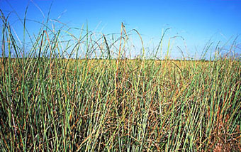
Plants in the list below have been recommended for use in marsh plantings or to stabilize tidal brackish or saltwater shorelines. Each plant has slightly different salinity and wetness tolerances. Before going to the time, effort and expense of planting a mini marsh the salinity of the area must be ascertained for comparison to salinity and moisture requirements for each plant. so they will be planted in the appropriate conditions. Those species for use in salinity greater than 15 ppt are marked (*).
Salt water Saw Grass Photo Florida Department of State
|
| Salt water Saw Grass Photo Florida Department of State |
Low Marsh Herbaceous
Juncus roemerianus *
|
Black needlerush
|
Peltandra virginica
|
Arrow arum
|
Pontedaria cordata
|
Pickerelweed
|
Spartina alterniflora *
|
Saltmarsh cordgrass
|
Spartina cynosuroides
|
Big cordgrass
|
Schoenoplectus (Scirpus) pungens
|
Three-square
|
Schoenoplectus (Scirpus) robustus *
|
Saltmarsh bulrush
|
Schoenoplectus (Scirpus) validus
|
Giant bulrush
|
High Marsh Shrubs
Baccharis halimifolia *
|
Groundsel bush
|
Iva frutescens *
|
Marsh elder
|
Morella (Myrica) cerifera *
|
Wax myrtle
|
Morella (Myrica) pensylvanica *
|
Northern bayberry
|
Beach/Dune Herbaceous
Ammophila breviligulata *
|
American beachgrass
|
Panicum amarum *
|
Bitter panicum
|
Panicum virgatum *
|
Switch grass
|
Uniola paniculata *
|
Sea oats
|
Useful Plant Links
Click on each habitat zone for native plants that could grow or could be planted there.

Plants for the Upland Bank - Salt Tolerant Native Plants for Upland Banks and Riparian Buffers (tolerates wind, airborne salt, salt in soil)
Deciduous Trees
Amelanchier canadensis
|
Shadbush, serviceberry
|
Celtis laevigatus
|
Sugarberry
|
Diospyros virginiana
|
Persimmon
|
Liquidambar styraciflua
|
Sweet gum
|
Nyssa sylvatica
|
Black tupelo
|
Prunus serotina
|
Black cherry
|
Quercus alba
|
White oak
|
Quercus phellos
|
Willow oak
|
Quercus rubra
|
Red oak
|
Quercus stellata
|
Post oak
|
Quercus virginiana
|
Live oak
|
Taxodium distichum
|
Bald cypress
|
Evergreen Trees
Ilex opaca
|
American holly
|
Juniperus virginiana
|
Eastern red cedar
|
Magnolia virginiana
|
Sweetbay magnolia
|
Pinus taeda
|
Loblolly pine
|
Shrubs
Aronia arbutifolia
|
Red chokeberry
|
Baccharis halimifolia
|
Groundsel bush
|
Clethra alnifolia
|
Sweet pepperbush
|
Ilex glabra
|
Inkberry
|
Ilex vomitoria
|
Yaupon holly
|
Iva frutescens
|
Marsh elder
|
Morella cerifera
|
Wax Myrtle
|
Morella heterophylla
|
Southern Bayberry
|
Morella pennsylvanica
|
Northern Bayberry
|
Prunus maritima
|
Beach plum
|
Rhus glabra
|
Smooth sumac
|
Sambucus nigra ssp. Canadensis
|
Elderberry
|
Vaccinium corymbosum
|
Highbush blueberry
|
Viburnum dentatum
|
Arrowwood
|
Grasses
Andropogon virginicus
|
Broomsedge
|
Panicum virgatum 'Heavy Metal'
|
Switch grass, tall
|
Panicum virgatum 'Cloud Nine'
|
Switch grass, short
|
Panicum virgatum 'Rotstrahlbusch'
|
Switch grass, red leaves
|
Schizachyrium scoparium
|
Little Blue Stem
|
Spartina patens
|
Saltmeadow hay
|
Vines
Campsis radicans
|
Trumpet creeper
|
Celastrus scandens
|
Bittersweet
|
Clematis virginiana
|
Virgins bower
|
Lonicera sempervirens
|
Coral honeysuckle
|
Parthenocissus quinquefolia
|
Virginia creeper
|
Passiflora incarnata
|
Passionflower
|
Herbaceous
Aquilegia canadensis
|
Columbine
|
Aster novae-angliae
|
New England aster
|
Asclepias tuberosa
|
Butterflyweed
|
Echinacea purpurea
|
Purple coneflower
|
Hibiscus moscheutos
|
Rose mallow
|
Kosteletzkya virginica
|
Seashore mallow
|
Liatris pilosa v. pilosa (graminifolia)
|
Grass-leaved blazing star
|
Liatris squarrosa
|
Blazing star
|
Lupinus perennis
|
Lupine
|
Opuntia humifusa
|
Prickly pear cactus
|
Rosa carolina
|
Carolina rose
|
Rosa palustris
|
Swamp rose
|
Rudbeckia hirta
|
Black-eyed susan
|
Rudbeckia fulgida
|
Orange coneflower
|
Solidago sempervirens
|
Seaside goldenrod
|
Yucca filamentosa
|
Common Yucca
|
Upland Coastal Native Plants (need some protection from wind, salt spray)
Trees
Acer rubrum
|
Red maple
|
Carya alba
|
Mockernut Hickory
|
Carya glabra
|
Pignut Hickory
|
Cercis canadensis
|
Eastern redbud
|
Cornus florida
|
Dogwood
|
Magnolia grandiflora
|
Southern magnolia
|
Sassafras albidum
|
Sassafras
|
Ulmus americanus
|
American elm
|
Shrubs
Hamamelis virginiana
|
Witch hazel
|
Ilex decidua
|
Possumhaw
|
Ilex verticillata
|
Winterberry
|
Rhus copallinum
|
Winged Sumac
|
Rhus hirta
|
Staghorn Sumac
|
Sambucus nigra ssp. canadensis
|
Elderberry
|
Vaccinium corymbosum
|
Highbush Blueberry
|
Viburnum prunifolium
|
Black haw, sweet haw
|
Grasses
Bouteloua curtipendula
|
Sideoats Grama
|
Chasmanthium latifolium
|
River oats
|
Dichanthelium commutatum
|
Variable panic grass
|
Muhlenbergia capillaris
|
Gulf Muhly
|
Panicum amarum
|
Beach Panic Grass
|
Schizachyrium scoparium
|
Little Blue Stem
|
Sorghastrum nutans
|
Indian Grass
|
Spartina patens
|
Saltmeadow Hay
|
Tridens flavus
|
Redtop
|
Vines
Bignonia capreolata
|
Crossvine
|
Gelsemium sempervirens
|
Carolina jasmine
|
Herbaceous
Aster novi-belgii
|
New York aster
|
Aster patens
|
Late purple aster
|
Baptisia australis
|
Blue False Indigo
|
Chrysopsis mariana
|
Maryland Goldenaster
|
Coreopsis lanceolata
|
Lance-leaved Coreopsis
|
Coreopsis tripteris
|
Tall Coreopsis
|
Coreopsis verticillata
|
Coreopsis
|
Echinacea pallida
|
Pale purple coneflower
|
Eupatorium coelestinum
|
Mist flower
|
Eupatorium perfoliatum
|
Purple boneset
|
Eupatorium purpureum
|
Joe-pye-weed
|
Helianthus giganteus
|
Giant sunflower
|
Heliopsis helianthoides
|
Ox-eye
|
Rudbeckia triloba
|
Thin-leaved coneflower
|
Sisiyrinchium angustifolium
|
Blue-eyed grass (iris family)
|
Solidago bicolor
|
Silver-rod
|
Solidago odora
|
Sweet goldenrod
|
Solidago rugosa
|
Rough-stemmed goldenrod
|
Solidago speciosa
|
Showy Goldenrod
|
Tidal Wetland and Beach / Dune Plants
Plants in this list can be used for marsh plantings or to stabilize tidal brackish or saltwater shorelines based on salinity and wetness tolerances. Check the salinity and moisture requirements for each plant so they will be planted in the appropriate conditions. Those species for use in salinity greater than 15 ppt are marked (*). (pdf version)
Low Marsh Herbaceous
Juncus roemerianus *
|
Black needlerush
|
Peltandra virginica
|
Arrow arum
|
Pontedaria cordata
|
Pickerelweed
|
Spartina alterniflora *
|
Saltmarsh cordgrass
|
Spartina cynosuroides
|
Big cordgrass
|
Schoenoplectus (Scirpus) pungens
|
Three-square
|
Schoenoplectus (Scirpus) robustus *
|
Saltmarsh bulrush
|
Schoenoplectus (Scirpus) validus
|
Giant bulrush
|
High Marsh Shrubs
Baccharis halimifolia *
|
Groundsel bush
|
Iva frutescens *
|
Marsh elder
|
Morella (Myrica) cerifera *
|
Wax myrtle
|
Morella (Myrica) pensylvanica *
|
Northern bayberry
|
Beach/Dune Herbaceous
Ammophila breviligulata *
|
American beachgrass
|
Panicum amarum *
|
Bitter panicum
|
Panicum virgatum *
|
Switch grass
|
Uniola paniculata *
|
Sea oats
|
Useful Plant Links
Here are some potential choices for a single plant marsh:
Smooth Cordgrass: Spartina alterniflora
Is probably one of the best choices. Smooth, or salt marsh cordgrass is the most common salt marsh plant from th eouter banks to the Carolinas to the Texas Gulf Coast. The plant t forms 1- to 8-foot-tall meadows that grow in the low marsh that is regularly flooded. Lush and green in the warmer months, smooth cordgrass becomes golden-brown in the fall and dies back in the winter.
Is probably one of the best choices. Smooth, or salt marsh cordgrass is the most common salt marsh plant from th eouter banks to the Carolinas to the Texas Gulf Coast. The plant t forms 1- to 8-foot-tall meadows that grow in the low marsh that is regularly flooded. Lush and green in the warmer months, smooth cordgrass becomes golden-brown in the fall and dies back in the winter.
Saw Grass: Cladium jamaicens
Often found intermixed or adjacent to Smooth Cord Grass Saw grass grows to about 6 or 7 feet tall. The plant has long, slender, narrow leaves that look like tall blades of grass. These leaves are stiff and tough, with tiny saw teeth around the edges. The top of saw grass has many branches and branchlets.
Often found intermixed or adjacent to Smooth Cord Grass Saw grass grows to about 6 or 7 feet tall. The plant has long, slender, narrow leaves that look like tall blades of grass. These leaves are stiff and tough, with tiny saw teeth around the edges. The top of saw grass has many branches and branchlets.
Glasswort or Pickleweed: Salicornia spp.
Glasswort is found throughout the marsh. It can be mixed in with cord grass or on the mud flats. Glasswort grows low to the ground (rarely over 2 feet tall) and has short fleshy green stubby spikes extending from a main stem. Glasswort looks like long green pipe cleaners attached to a long stem. Three species are found in coastal marshes, and one turns pink in the fall.
Glasswort is found throughout the marsh. It can be mixed in with cord grass or on the mud flats. Glasswort grows low to the ground (rarely over 2 feet tall) and has short fleshy green stubby spikes extending from a main stem. Glasswort looks like long green pipe cleaners attached to a long stem. Three species are found in coastal marshes, and one turns pink in the fall.
Salt (or Spike) Grass: Distichlis spicata
Salt grass is a short, green, wiry grass that lives in irregularly flooded salt marshes, brackish marshes,which has the advantage of being short and thus being less objectionable to that portion of the public that might demand a scenic easement from the taller grasses. Unfortunately it is not as salt or wave tolerant as the taller grasses commonly). establishing and maintaining this plant would require some hard structures and the attendant requirement for plans, drawings, environmental impact statements etc, However once a protective barrier of one or more of the taller grasses is established this grass may well colonize behind the tall grass barrier. This plant is often found among the salt meadow cord grass above the high tide line or in pure stands in wet depressions. Flowers from June through October.
Salt grass is a short, green, wiry grass that lives in irregularly flooded salt marshes, brackish marshes,which has the advantage of being short and thus being less objectionable to that portion of the public that might demand a scenic easement from the taller grasses. Unfortunately it is not as salt or wave tolerant as the taller grasses commonly). establishing and maintaining this plant would require some hard structures and the attendant requirement for plans, drawings, environmental impact statements etc, However once a protective barrier of one or more of the taller grasses is established this grass may well colonize behind the tall grass barrier. This plant is often found among the salt meadow cord grass above the high tide line or in pure stands in wet depressions. Flowers from June through October.
Salt Reed or Giant Cordgrass: Spartina cynosuroides
Salt reed is a member of the same family as salt marsh cordgrass. This grass has many features in common with salt marsh cord grass. The name of the plant suggests that this grass grows taller (up to 10 feet) and thicker than Spartina alterniflora.
Salt reed is a member of the same family as salt marsh cordgrass. This grass has many features in common with salt marsh cord grass. The name of the plant suggests that this grass grows taller (up to 10 feet) and thicker than Spartina alterniflora.
Turtle grass (thalassia testudinum) is a sea grass that typically grows about 16 feet into the ocean.It is mostly a bottom dweller. This plant adds depth to storm water run off applications and is mostly invisible to the casual observer. It produces a small, yellow flower, and germination from turtle grass usually takes 14 days. Some turtle grass will grow as far as 45 feet into the ocean's floor.This plant is highly salt water tolerant.
Awl-leaf Arrowhead: Sagittaria subulata This plant can be found along brackish water shore lines and exhibits a fair amount of resistance to salty conditions. It almost looks like a bulb plant and would be easy to plant but might need dome protection to survive.
Check out : Mississippi Aquatic Plants Website http://jcho.masgc.org/
Regardless of which plants or mix of plants appeals to the planners one can only plant those plants that are readily available. In our next installment we will look at sources for plants. Sources may limit the plant choices described above.
No comments:
Post a Comment