Thursday, December 29, 2016

PROFESSIONAL MARINERS BEWARE

MARITIME INSTRUCTOR IN LOUISIANA CHARGED WITH SELLING FAKE DP TRAINING CERTIFICATES:

File photo
Image From Linked gCaptain Post

Louisiana Maritime Instructor Charged with Selling Fake DP Training Certificates

Wednesday, December 28, 2016

THE GREAT NAMAZU ADDRESSES THE END OF THE MICROCHIP REVOLUTION

Sponsored by Helios Ruehls, Inc.


GREETINGS BIPEDS !

Too much of the US population has been either falling out of the middle class ranks , or upon entering the country legally or illegally, failing to rise into the middle class ranks since the 1970s. This downward trend in upward economic mobility has been paralleled by an upward trend in US individual worker productivity. That upward trend in productivity coincides with the start and growth in the commercial and consumer use of devices based on microchip technology. 
Image result for Images of microchips
Are Micro Chips Old Hat Now?

The microchip industry that propelled this growth in productivity is now nearing the half century mark. The micro chip is certainly now a mature product. We believe based on our contacts with the innovative Helios Ruehls Inc. that while there may not be much new to come in micro chips per say, the microchip launched revolution is not as over as some analyst would have you believe. "The Internet of Things" promises to link for interaction a wide variety of "computerized", or computer based devices. NEMS (NANO Electro-Mechanical Systems) and MEMS (Micro Electro -Mechanical Systems) may hold the promise of yet another round of productivity revolution. But two schools of thought indicate that the aging of micro chip technology and the emergence of NEMS and MEMS based interlinked technologies don't make for a bright employment out look. Indeed as productivity is going up, the number of workers needed at all levels is shrinking in proportion to the tons, gallons, crates,  service hours, etc.being produced for sale. 

Economist George Friedman recently commented that in terms adjusted for inflation, U.S. productivity in 2016 produced its first decline in more than ten years. According to Friedman this decline in productivity may mark the start of a global shift in productivity. The rise in productivity caused by the wide use of microchip technology that launched the economic expansion that started in 1982  is sliding into an irreversible decline. My thought as your giant catfish scioeconomic analysts is that sounds like biped speaks, not with a forked tongue, but inadequate insight. I have to agree the micro chip "revolution" is old hat. However, I doubt that anyone is going to go backward in technology for manufacturing or delivering services.  I don't see any decline in employment based on stagnant microchip technology. I actually see an increase in productivity based on MEMS and NEMS technologies, but a related decrease in employment. In a nut shell we need fewer and fewer people to produce ever increasing amounts of wealth. Unfortunately, unless you bipeds start using common sense there will be no one left gainfully employed and thus having the medium of exchange (money?) to buy all this production?  Increases in productivity are a good thing but they can lead to reductions in the compensated work force which is the death knell of an economy.

 Whats the solution? First face the inevitable. An economy that can produce endless wealth but few jobs is already evolving. There will be no one to buy the production if our economy remains based on the James Town principal of "he who doesn't work doesn't eat". History also teaches us that the collectivist solution such as communism and socialism don't work.

  The answer has to be in the reform of labor laws that redefine the ideas of "career", and "retirement". We must link health insurance and retirement benefits to steadfast participation in an identifiable productive field. We must increase unemployment compensation and non loan educational assistance to deal with the fact that most young workers are going to be involved in a protracted period of at best intermittent work experience mixed with protracted training periods before they can compete with better trained older workers for those few full time jobs. Social Security is headed in the wrong direction, instead of raising the retirement age, it needs to be lowered to encourage older workers to rotate out giving the younger workers a real shot at the shrinking full time job market. The Congress needs to balance the budget and start to pay back all those IOUs in the social security fund that they borrowed for other purposes. Some general revenues need to go into the social security fund to pay the debt to the fund. Some general revenues presently marked "welfare" need to go into social security and unemployment compensation. Ultimately part of the great savings that industry is experiencing due to productivity increases should be taxed to support an economy characterized by a shortage of full time employment, a highly educated work force, and lengthy career preparation. This is of course too far "left" for the right and demands a commitment to education, training, and career development of the electorate, vice being on a straight forward government dole. The left won't like it. That alone should tell you that I'm on the right track. No one likes this plan because everyone's pet ox gets gored, a sure sign of a real solution.
http://www.breitbart.com/california/2016/12/14/end-microchip-revolution-bad-news-wages/?utm_source=feedburner&utm_medium=feed&utm_campaign=Feed%3A+breitbart+%28Breitbart+News%29

Monday, December 19, 2016

THE HISTORY OF ISLAM'S AGGRESSION AGAINST THE WEST


Public Domain Based On Age Of Work (over 70 years since death of artists)

Educators maintain that we retain only about 10% of what we read, but 50% of what we see and hear. This is why visual aids are so important in teaching. Hordes of Muslim Jihadists have been attacking Western Civilization for about 1400 years with only a few breaks. Unfortunately, the recent onslaught happens after the Jihadists assisted  the Nazis in World War II. Few liberals alive today and attempting to dominate public policy and public information were adults in WW II and so the most recent onslaught that they think started in New York on "Nine Eleven" and in their mind is the activity of a tiny group of "radicals" and has "nothing to do with Islam" is simply not seen by the liberals as having any previous history. Of course to the liberal mind only their view  or non-view of  history counts. We think it is important that Westerners know the full and real history of the 1400 year old war of Islam upon Christianity, Judaism, Western Civilization generally and also the Hindus of India and other Eastern non Muslim civilizations. We've been printing information and linking readers to other printed information, and linking them to sites and books  on this subject for some years. Perhaps its time to link to videos, with their easier to digest and retain features. Try at least one of these linked videos a day

The Start of the Islamic Civil War Still in Progress:

https://www.youtube.com/watch?v=no5RCHRbknk

 This 14 minute video picks up the story of Islam at the death of Mohammed and the split over Islamic leadership. It explains the split that we now know as the Shite / Sunni split a primary source of contention between Muslims in the world today. It also describes the start of the warfare on the west with the Islamic "Conquest of The Lavant 632-661 AD


How many times Muslims invaded Europe vs. Europeans invaded Muslim countries? 
 https://www.youtube.com/watch?v=c7y2LRcf4kc

This 3 minute video utilizes a series of maps to illustrate the military campaigns of the Islamic World against the Christian World, includes a comparison of Islamic attacks vs the "Crusades".

Siege of Vienna [Documentary]1529 https://www.youtube.com/watch?v=pPXDgUrg5E8  and then they came again in 1683 and inbetween to Malta in 1565

Malta 1565  https://www.youtube.com/watch?v=skcG7esLZnw

And later there was sea Battle of Lepanto 1571 https://www.youtube.com/watch?v=NcNPKHopeoQ and finally the Siege of Vienna in 1683


Siege of Vienna 1683 https://www.youtube.com/watch?v=pc-RWtovrqg

 The siege of the Western World continues today, the suppression of native Asian religions continues unrelenting. The Muslim assault on freedom loving mankind never really stops. It makes strategic withdrawals, gathers strength , and resumes the relentless attack, while the rest of mankind tends to forget history. Those who forget history are doomed to repeat it. Learn the truth about Islam, it can not only save your life and freedom, it can save civilization.

NOAA TERMINATES NON NOAA CHART UPDATING WEB SITES

Navigation Systems Information
NOAA terminates the Chart Updating website 


Nautical chart of Portuguese cartographer Fernão Vaz Dourado (c. 1520 - c. 1580), Public Domain Based on Age of Work (More Than 70 Years Since Death of Author)


See Our Related Post THE UNDERLYING INACCURACY IN TODAY'S NAVIGATION

On April 19, 2016 the USCG Auxiliary Chart Updating Reporting Webpage (CUWeb)was shut down permanently.  As was that of the US Power Squadron. NOAA cut off the links due to cyber security considerations. It was determined by NOAA that the two cooperative web sites facilitating access to the NOAA chart updating net work might allow hackers a backdoor route to gain access to government internal networks. NOAA does not intend to bring the sites back on line in the future, the cyper security issue only appears to be able to be secured by closing the NOAA connection. It looks like this is the permanent solution.
 However at lest the Coast Guard Auxiliary reports that the closing of CUWeb does not spell the end to the Auxiliary Chart Updating (CU) program.  The Coast Auxiliary feels that Chart Updating "still plays a vital role in promoting safety on the water."  The Auxiliary will continue to teach chart updating methods. The Auxiliary notes .." The same information that was being provided through CU Web can still be sent to NOAA, however without the aid of the structured CU Web report format web page.  Chart corrections and discrepancies can be submitted to NOAA through the Inquiry and Discrepancy Report System (IDRS)" at  http://ocsdata.ncd.noaa.gov/idrs/discrepancy.aspx ".

 It should be noted that all mariners may report observed chart discrepancies to NOAA  @  http://ocsdata.ncd.noaa.gov/idrs/discrepancy.aspx

 As noted in our post 
THE UNDERLYING INACCURACY IN TODAY'S NAVIGATION The processes of gathering original "datum", updating, and correcting charts are still more labor intensive and slow than obtaining an accurate fix of position from the GPS system. That super accurate GPS "fix" will definitely show you your vessel's longitude and latitude with previously unprecedented accuracy. However, when you chart that position your proximity to navigational hazards may not be nearly so accurate due to the manual processes that still dominate the depiction of basic datum like coast lines, and navigational features, and updating such information on a regular basis. 

Sunday, December 18, 2016

THE UNDERLYING INACCURACY IN TODAY'S NAVIGATION

A NOAA PAPER CHART, IMAGE COURTESY NOAA


Navigational forensic experts of the American Admiralty Bureau, Ltd have frequently described for American courts the standard of navigational accuracy for non electronic navigation. In terms of fixing position when navigating with magnetic compass, paper charts, parallel rules and dividers it is generally plus or minus 200 yards of true position. "True position" today may be determined within 50 feet or less using GPS. Unfortunately the value of knowing your "True Position" ( exact latitude and longitude on the face of the earth ) isn't of the same value at all times and in all places. Crossing a deep portion of ocean with no surface features and depths far beyond the deepest ship's draft there is little to worry about whether you are 200 yards off or less than 50 feet off. But in confined or obstructed waters, or waters transitioning from deep to shallow the tendency to crank up and rely on the GPS linked electronic chart display even when it is working to its most efficient performance can prove deadly. Despite the fact that mariners can now print out their own paper charts or dial up electronic charts "updated" to the day you print them out, there are hidden dangers. The new "updating" may alert you to the location or approximate location of new known obstructions but that is not enough to warrant the seemingly blind trust than many younger professional mariners put in electronic navigation. The GPS may show you on the chart your precise position in terms of longitude and latitude but you might be 200 yards nearer or farther off from that rock, shoal, shallow area, or beach line than your "updated chart " indicates.  

 The "datum" on your navigation chart, unlike your own GPS generated position may be decades or even centuries old, and formulated using pre-electronic navigational systems. NOAA and the British Admiralty are working on improving basic chart datum like depths, bottom types, positions of land forms, rocks, etc.. But this is still slow time consuming work. The painstaking nature of updating basic chart datum is the one of the main reasons why NOAA maintains its Atlantic and Pacific Fleets of research ships, boats, and air craft. Satellites help but most often there has to be a survey ship visit to the sites incorporated onto navigation charts. Time, skills, professional effort, and serious expense are involved, the work is never finished, and tends to move slowly. The prudent mariner never fully relies on assumptions , if you can't verify the accuracy of your chart's under lying data, don't assume that your estimated proximity to navigational hazards is vastly improved by your electronically produced fix of position.  You must always consider datum reliability in factoring safety margins. The older your chart datum, the less reliable it is, and the greater margin for error for safe passage you should allow. 
 Fortunately today , at least the new NOAA charts help you to estimate the reliability of datum. NOAA now marks its chart products with notations /diagrams on "ZONES OF CONFIDENCE" (ZOC) . The ZOC diagrams and notations address information on such datum as age of information , position accuracy, and seafloor coverage.

NOAA SURVEY SHIP THOMAS JEFFERSON IMage by NOAA

The information is graded for probable accuracy. The grades range from A1, B, C, and D in order of most reliable to least reliable. In addition there is an additional "MD" rating for maintained depth reflecting channels with maintained depths and regular surveying. In a nut shell, today we are navigating electronically with far more horizontal position accuracy than what was available to the surveyors who produced the basic depictions of land forms, depths, and hazards typically represented on even our electronically displayed or printed charts still commonly in use. Learn to look for and use those ZOC markings  and don't assume anything. Factor in safety margins like you were still limited to plus or minus 200 yards or more on your horizontal position accuracy. Don't trust , verify. Remember you are obligated to use every available means to navigate accurately and avoid collision, allision, or grounding. 

Friday, December 16, 2016

CHINA SEIZES US NAVY UNDERWATER RESEARCH DRONE

map
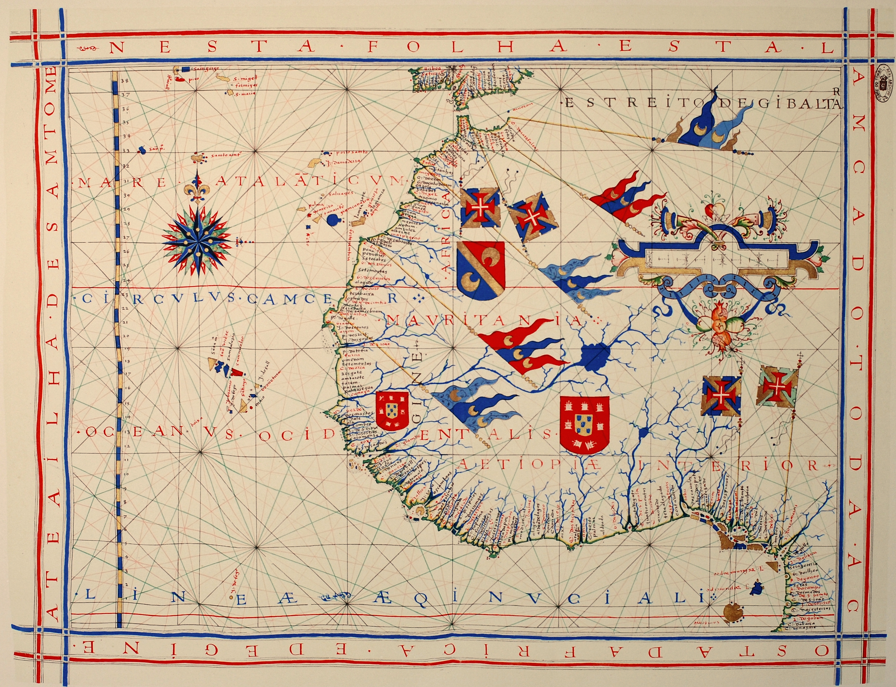
Map, screen capture from linked post @ BBC NEWS

Update 5/22/2017 : The Drone was returned after allowing sufficient time for Chinese forensic engineering examination without a lot of protest over our being in China's claimed sovereign waters. After all, as the chart indicates above, we were barely a rifle shot off of the Philippine beach and hundreds of sea miles from China. 

Latest Update: China now says it will return the Drone and complains of American "Hyping of the incident". The Chinese communications don't mention any matters of soverignity over the waters involved and read like they were simply investigating and removing what they felt was a potential hazard to navigation. This of course ignores the fact that the Chinese ship operated within 500 yards of the USNS BOWDITCH, which was retrieving identical objects, and ignored the signals and radio calls of the BOWDITCH . The last and only radio response by the Chinese ship was a terse radio announcement "Resuming normal operations" as it sped away from the scene with the drone on board. We continue to believe this was a carefully orchestrated demonstration designed to test the resolve of the United States to insist on the application of well documented international law in the South China Sea. We have no idea if the apparently quickly moderated position of China and their lame excuse was in response to the Obama Administration's publication of the U.S. protest, or the Trump tweets on the unprecedented nature of the events, or some combination of the two. Whatever it was it led them to understand that the behavior was illegal and unacceptable, and not likely to enhance their position relative to the control of South China Sea waters with the community of nations or their own coastal neighbors. So the drone is quickly returned and the United States publicly chided for "over hyping " the incident. Dragons speak with forked tongues, what did you expect? 

 Check out the location of the seizure of an unmanned underwater research drone depicted in the chart above. While the chart is an illustration from the BBC News Site and not a navigation chart this much is obvious, the seizure happened within the Philippine Exclusive Economic Zone (EEZ) and nowhere near China's EEZ much less territorial seas. Again while stressing that the illustration is not a navigational chart, Using the illustrations scale the site of the event appears to be about 50 miles off of the nearest point of land in the Philippines, well within the internationally recognized EEZ of the Philippines and well within a number of internationally recognized customs enforcement and defensive zones of the Philippines. More aggravating still concerning this unlawful seizure by China, the drone in question belonged to a United states Navy ship and was clearly marked as such.
USNS Bowditch
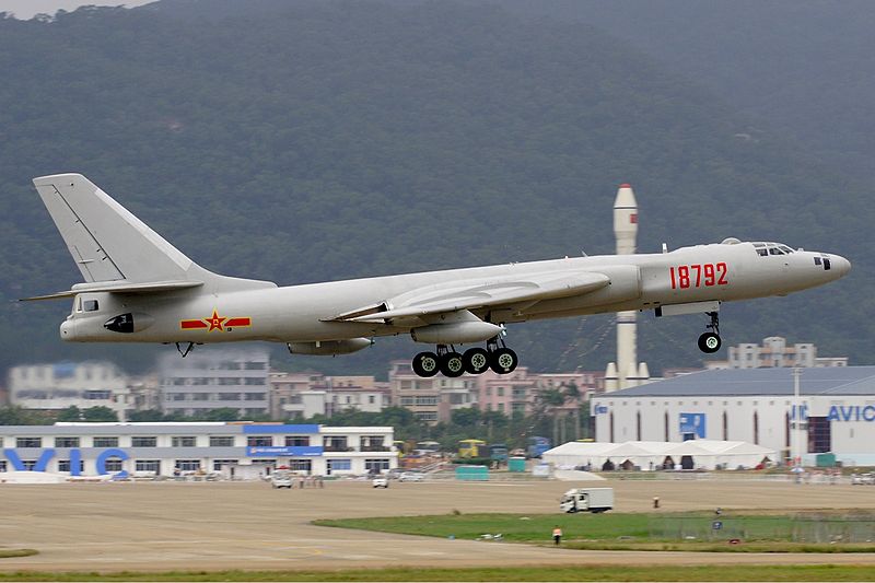
USNS BOWDITCH, NAVAL RESEARCH VESSEL

Under international law, war ships (combatants and auxiliaries) are treated as sovereign parets of the flag state's territory and immune from search and seizure. One might debate the status of a naval research vessel, byt the BOWDITCH is a US naval ship and generally her "ship's boats" should enjoy the same immunities as the ship itself. Underwater drones present something of a grey area. But this incident does illustrate China's extreme disregard of the sovereignty of the Philippines , and a willingness to push its illegal claims in the South China Sea right up a potential act of war with the United States. The amount of legal "grey" cover that the unique status of the Bowditch and an unmanned drone  provide China with is so thin than only extreme confidence in the Obama Administrations determination to do nothing in the face of provocation could account for their callus disregard for International law. If the Dragon makes a similar move 50 days from now the results might be very different. 

UPDATE : 12/17/2016

 The unprecedented nature of this seizure apparently is driving the situation on both sides. While an attack on a war ship's small craft is considered a clear cut act of war under existing international law, the BOWDITCH is a Us Navy owned, largely civilian contractor manned oceanographic research vessel. The submarine drone is unmanned the situation brings up elements of international maritime law involving both "ship's boats" and submarines, complicating legal analysis by both sides. The Chinese decision to seize a US owned drone deployed from a US Navy owned vessel only 57 miles at sea from Manila in the Philippines, clearly within the Philippine's exclusive economic zone is unprecedented but not truly unexpected. The Dragon was senmding a message that it has no intention of obeying recent International Court decisions that reject the Dragon's arguments that it owns all the waters within their infamous "9 Dash Line", virtually all of the South China Sea almost to the beaches of the Philippines. Based on the UN Law of the Sea Convention which China is signatory to the Philippines is entitles to a 12 mile territorial sea and up to a 200 mile exclusive economic zone EEZ where such a seaward boundary does not intrude into a comparable region with another coastal state. Where 200 mile EEZs over lap negotiation in good faith is required to formally set the EEZ boundaries. China has publicly announced to the world that it has no intention of honoring the provisions of the treaty they signed, now that the have the naval power to bully their neighbors. The US response has been stepped up naval transits of the area. This seizure within the Philippine EEZ of a US asset was carefully designed to demonstrate their resolve. We don't think that this was a rash act by an over zealous and under controlled Chinese ship commander, but a carefully planned demonstration on an object and vessel colored by a significant amount of legal grey so as to raise US anxiety over the issue but not generate a clear cut "Act of War."  If not reacted to properly eventually some Chinese ship commander will step over that line. The closing days of the Obama administration we believe were chosen because the Chinese felt certain of a weak reaction.

 Well the reaction appears muted on both sides. The "incident: is "being handled military to military", meaning the US Navy and the People's Liberation Army's Navy are working it out among themselves. We bet the US gets its drone back, but the Chinese are not required to make any admissions or make any promises to avoid this illegal behavior in the future. This means the Trump administration is forced by the outgoing Obama administration to take over the South China Seas issues with the Chinese already assuming that their naval activities within other peoples national waters will be tolerated  up to and including patrols and some seizures within other nations EEZ's. The first incident the Dragon engineers after Trump takes office will result, and certainly be played by the US media, China's staunch ally, as an "escalation", "dangerous belligerency" by the Trump administration. Once again we've been had by the Dragon and the American main stream media.

Below is a link to the MSN coverage of the "Navy to Navy handling" decision. Notice how many paragraphs they devote to describing Mr. Trump's occasional ( and later corrected) spelling errors in his tweets of the events. MSN misses the point entirely of Mr. trumps Twitter habit. He uses twitter and the social media to communicate over the heads of the main stream media directly with the American people who are fed up with politically correct but treasonous journalism, and quite patient with things like an occasional spelling error. Follow the link below if you want to follow the latest from the MSM:

China says 'appropriately handling' US Navy drone issue ( Associated Press Article by CHRISTOPHER BODEEN, as carried on MSN Internet site). At the same site you can watch a video on the issue from FOX News 


http://www.msn.com/en-us/news/world/china-says-appropriately-handling-us-navy-drone-issue/ar-AAlEdKq?li=BBnb7Kz&ocid=wispr  

CHINA RETURNS DRONE: http://www.vox.com/world/2016/12/20/14012922/pentagon-underwater-navy-drone-china-seized-trump-taiwan

Wednesday, December 14, 2016

VIDEO BACKGROUNDERS ON THE HIGH ARCTIC

U.S. Navy sailors and members of the Applied Physics Laboratory Ice Station clear ice from the hatch of the USS Connecticut as it surfaces above the ice in the Arctic Ocean. Wikimedia Commons/Public domain
Illustration from the Post :THE BATTLE FOR THE ARCTIC as published in NATIONAL INTEREST MAGAZINE 
 The links below the illustration above connect you to a rather comprehensive on line print article on the "contests" in the High Arctic over the natural resources and potential  ice free "passages" in the region. Below are informative video links on issues in the High Arctic region

Putin's Arctic Ambitions  https://www.youtube.com/watch?v=pbrKLnh8wLA  11+ minute background on Russia's intentions for the High Arctic and Russian Capabilities

Geopolitics of the Arctic https://www.youtube.com/watch?v=dV67yJHoPvw  11+ minute background on the geometry and economy and politics of the High arctic, but does assume global warming. We believe that the drive for resources in the High Arctic are not dependent on global warming. Otherwise this is a pretty informative and useful background exploration of the region and issues.

Russia's Arctic Ambitions https://www.youtube.com/watch?v=Q1Ij2ISC_uU -3 minute video on Russia's Arctic ambitions

Tuesday, December 6, 2016

MSN REPORTS CHINESE BOMBERS CIRCLED TAIWAN


China Circled Taiwan With Nuke-Bombers Before Trump Call

File:PLAAF Xian HY-6 Li Pang.jpg
CHINESE HY-6 BOMBER Photo by Li Pang  Ahuhai Air Show 2008  GNU Free Documentation License

"BEIJING — China encircled the self-ruled island of Taiwan with nuclear-capable bombers as part of its first long-range surveillance mission, Taiwanese officials said Tuesday.
The Nov. 25 incident came a week before Taiwanese leader Tsai Ing-wen called President-elect Donald Trump in a conversation that broke decades of diplomatic protocol with Beijing."
"Four of the aircraft flew an anti-clockwise loop round Taiwan, an island a little larger than the state of Maryland that China sees as a breakaway province, before meeting up with the other two planes to the north of the country, Chen said. He did not specify which planes made the complete lap.
None of the planes entered Taiwan's airspace nor its air defense identification zone, the spokesman added.
He said it was the first time Chinese aircraft have encircled the island on what he described as long-distance surveillance mission." READ THE ENTIRE STORY AT NBC NEWS

Monday, December 5, 2016

THE HISTORY OF NAVIGATION


File:CYA Coastal Navigation With Dead Reckoning 2.jpg
Image by J. S. Bond, This file is licensed under the Creative Commons Attribution-Share Alike 3.0 Unported license.

 Interested in studying marine navigation, or expanding your knowledge? A great place to begin is  our NAVIGATION AND CARTOGRAPHY SECTION where you will find a growing collection of instructional and entertaining videos. You will also find book reviews and suggestions on navigational titles, information on electronic navigation, and information on the various uses of cartography, and much more. If you are an absolute beginner its always fun to be introduced to a subject via its history. Navigation both western arts and sciences and Pacific Islander versions have a unique and colorful history. The commercial methods today follow the Western methods. The PBS network show NOVA produced an excellent video on the search for the methods of determining longitude, this is a great place to begin your study. We keep a link to this video in our
 NAVIGATION AND CARTOGRAPHY SECTION  but if you would like to view it directly it is on Youtube as THE HISTORY OF NAVIGATION . In the event that these links degrade before we get around to checking them again, the URLs are shown below and when posted werer "hot links" themselves.
 Dare to sail out of sight of land. Learn to navigate !


http://americanadmiraltybooks.blogspot.com/p/navigation.html

https://www.youtube.com/watch?v=_G9LzpBi1Yk

Friday, December 2, 2016

NASA BREAKS RANKS ON CLIMATE CHANGE


American Admiralty Books Safety & Privacy Policies   EU VISITORS WARNING POSSIBLE COOKIES AHEAD


 The National Aeronautics and Space Administration (NASA) has broken ranks with most of the Federal agencies and now runs the risk of being labeled a "Climate Change Denier", an accusation that certain elements in the Democratic party wanted to make a criminal offense not long ago.. In the space game there is little room for error, supposition, or sloppy math. NASA may not be in the climate / weather prediction business like NOAA but does launch weather satellites, and must engage in long term and expensive planning of things like launch and support sites, and space ports. The things that NASA does are expensive, but often viewed as a luxury / status item by many tax payers and their elected representatives. NASA can't afford to waste money. Should the space facility at Cape Canaveral be moved since some in the climate change camp predict that it will be submerged in ten years? Should sea level monitoring satellite systems become a top priority, virtually an emergency funded program as the climate alarmists urge? NASA took a long hard look, while being bombarded with the Obama Administration's hard line on man caused catastrophic climate change, swallowed hard....and broke ranks.. 

 The "debate", if one could actually call this propaganda campaign over Man-made Climate Change, aka Anthropogenic Global Warming, a "debate", has been raging for decades now. The mainstream media has reported for a generation a bogus "consensus" among "97% of climate scientist" that "global warming is real and caused by human activity." For the Obama administration and other globalists this appeal to scientific "consensus" is cited as justification for their call to criminalize "climate -deniers", a term of their own invention for anyone who wants to see real data. For years now data has been stacking up that throws cold water on the supposed scientific "consensus". Unfortunately, if a scientists worked for a university receiving major Federal funding or for a Federal agency any deviation from the the approved position could be a career killing utterance. But NASA has decisions to make that are impacted by climate, and a scientific reputation to protect. So even with the Obama administration and PC police still in office, the agency recently broke ranks:  
 Below are a few quotes from the ETF NEWS story on the recent NASA announcements titled "

NASA Drops Global Warming BOMBSHELL, Liberals In Panic Mode As Scam Exposed

"Unfortunately, government-funded science is not infallible, and does not always follow the same methodology. Different studies can produce wildly different results, and discoveries previously thought to be inarguable are often revealed to be false after new information comes to light."

"When it comes to man-made climate change, we must factor in that the issue has been incredibly politicized. When you mix divisive politics and government funding in with science, you can expect that the findings will not always be accurate."

"With the issue of climate change, the incredible amount of money and power at stake also plays into the equation. From the earliest days of research on the “Greenhouse Effect”, there have been profound implications for the global economy, and particularly for the nations deemed to be the worst polluters. The idea of financially penalizing industrialized nations, through carbon credits and other schemes, has been part of the global warming cause since the beginning."

The new data that has emerged from NASA satellite measurements, tells us that mainstream science may have gotten this issue totally wrong. What they have reported as human-caused climate change could actually turn out to be just the effects of one of the strongest El Nino systems we’ve seen in decades."

"From 1998 to 2013, global temperatures were relatively stable, with no major increases measured. The models developed by the experts in the field had failed, casting doubt on their methodologies. The response from the mainstream scientific community was to develop new models, and introduce new variables, in order to generate an explanation for the slowdown."

READ THE ENTIRE ARTICLE @:

http://endingthefed.com/nasa-drops-global-warming-bombshell-liberals-in-panic-mode-as-scam-exposed.html#.WD9Odo9DPn4.twitter