WELCOME TO AMERICAN ADMIRALTY BOOKS!

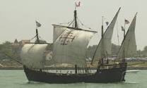
Barque: ALEXANDER VON HUMBOLT II, Named for the Oceanographer
Photo by Hans Georg Schroder
WEDNESDAY OCTOBER 31, 2012
NEW TO OUR SITE? WONDER WHAT WE ARE ALL ABOUT? CLICK ON THIS LINK FOR AN ENTERTAINING VIDEO EXPLANATION http://www.youtube.com/watch?v=AFw32RRJY98:
If you want more detail after the video click on the INTRODUCTION page in the right hand margin.
------------------------------------------------------------------------------------------------------------
NEWS FLASH: SEE LATEST BLOG POST ( scroll down)
The "Ego Alley" canal and turning basin in Annapolis over topped its banks during Frankenstorm Sandy and water may have entered the famed and beloved Fleet Reserve Club.
------------------------------------------------------

SPACE AS AN OCEAN
We 'd like to thank all of our visitors who read the Space as an Ocean Series. The entire series in chronological order of appearance is posted in the MARITIME LITERATURE SECTION. To the right of our sailing vessel image you'll see a list of special sections starting with INTRODUCTION. Scroll down and click on MARITIME LITERATURE. Once in MARITIME LITERATURE simply scroll down until you see images of a Caravel sailing ship under sail and a Space Shuttle on takeoff.
------------------------------------------------------------------------------------------------------------
NEW AND RECOMMENDED FOR THE SERIOUS SAILOR, NAVAL ARCHITECT, MARITIME HISTORIAN, AND BOAT BUILDER.
Click on this icon to order book or peruse through the Amazon description.
---------------------------------------------------------------------------------------------------------------
http://www.youtube.com/watch?v=tiyKiUCiKcE
-
If you want more detail after the video click on the INTRODUCTION page in the right hand margin.
------------------------------------------------------------------------------------------------------------
NEWS FLASH: SEE LATEST BLOG POST ( scroll down)
The "Ego Alley" canal and turning basin in Annapolis over topped its banks during Frankenstorm Sandy and water may have entered the famed and beloved Fleet Reserve Club.
------------------------------------------------------
SPACE AS AN OCEAN
LESSONS FROM THE AGE OF EUROPEAN MARINE EXPLORATION FOR THE SPACE AGE.
From the Book "PROTOCOLS" (c) 2012 by American Admiralty Books
SPACE AS AN OCEAN
We 'd like to thank all of our visitors who read the Space as an Ocean Series. The entire series in chronological order of appearance is posted in the MARITIME LITERATURE SECTION. To the right of our sailing vessel image you'll see a list of special sections starting with INTRODUCTION. Scroll down and click on MARITIME LITERATURE. Once in MARITIME LITERATURE simply scroll down until you see images of a Caravel sailing ship under sail and a Space Shuttle on takeoff.
------------------------------------------------------------------------------------------------------------
NEW AND RECOMMENDED FOR THE SERIOUS SAILOR, NAVAL ARCHITECT, MARITIME HISTORIAN, AND BOAT BUILDER.
 |
| Illustrations, photos, drawings, plans histories and more on the schooner designs of William Burgess, Cox and Stevens, Samuel Crocker, the greats of American schooner design A reference work for yacht designers, and nautical historians ,and a work of art for the rest of us. If you have a serious sailor on your Christmas list just click on the book cover icon link below and put one of these babies in your Amazon shopping basket |
Click on this icon to order book or peruse through the Amazon description.
---------------------------------------------------------------------------------------------------------------
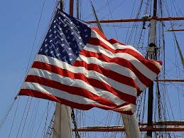
The National Anthem to day is presented with all of the words as written by Francis Scott Key. We have previously presented the mostly forgotten final stanza, but there is more. Click on the link below for the Star Spangled Banner as you have never heard it before. Everything else has been a pale shadow of the original. All words appear in print as well. We are going to run this version for a while and then repeat it often.
http://www.youtube.com/watch?v=tiyKiUCiKcE
-